Catalog Archive
Auction 188, Lot 526

"Exactissima Tabula, qua tam Danubii Fluvii Pars Superior, ab Ejus Fontibus ad Posonium Urbem et Minores in eum Influentes Fluvii...", Visscher, Nicolas

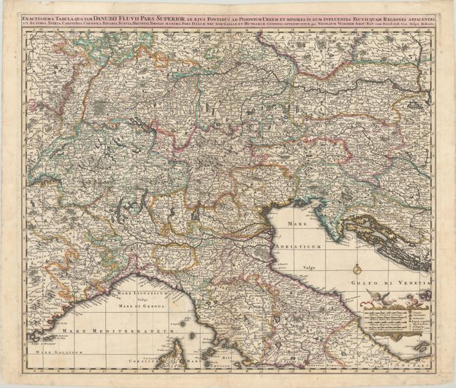
Subject: Southern Europe

Period: 1690 (circa)

Publication:

Color: Hand Color

Size:
22.3 x 19.4 inches
56.6 x 49.3 cm
Download High Resolution Image
(or just click on image to launch the Zoom viewer)

This finely detailed map covers the region of northern Italy, Switzerland, Austria, Slovenia, and Croatia, with parts of northern France, southern Germany, and Czechia as well. It spans from Geneva east to Presburg (Bratislava) in the east, and from Nuremberg south to Rome. The course of the Danube is prominently shown from its headwaters in the Alps to its confluence with the Morava River. There is a decorative cartouche held up by putti featuring four distance scales and a key.

References:

Condition: B+

A crisp impression with a few small, light stains in the map image, light soiling, and a 2.5" split along the lower centerfold.

Estimate: $325 - $400

Sold for: $200

Closed on 6/22/2022

Archived