Subject: Pacific Ocean, East Asia
Period: 1943 (dated)
Publication:
Color: Printed Color
Size:
45.9 x 33.6 inches
116.6 x 85.3 cm
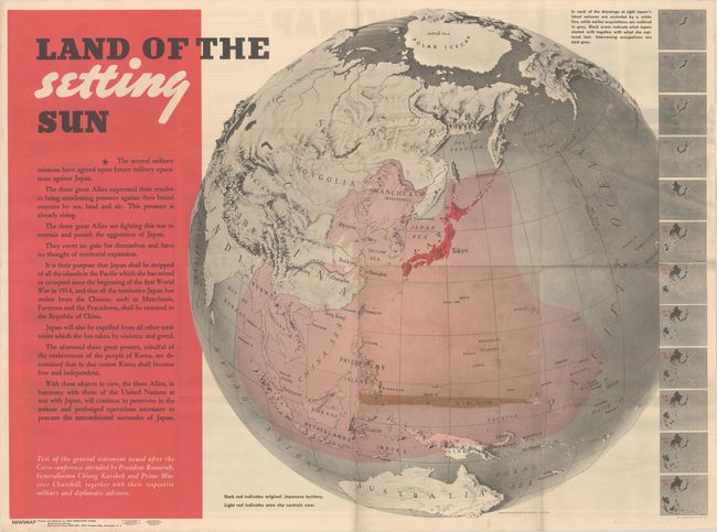
This superb three-dimensional map of eastern Asia and the Pacific Ocean was drawn by Richard Edes Harrison. It graphically depicts the increasing territorial expansion of Japan between 1875-1942, with the area controlled by Japan highlighted in pink. At right are smaller maps that show how Japan seized territory over the years. The long quote at left was extracted from a statement issued by the Cairo Conference in November 1943, explaining that the three great Allies (United States, United Kingdom and China) would "restrain and punish the aggression of Japan" and that Japan would be "expelled from all other territories which she has taken by violence and greed."
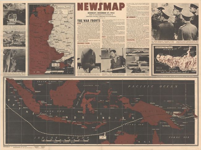
On verso is the Newsmap for December 16-22, 1943, with details on the war front, photographic images of the war, and maps of the East indies, the island of New Britain, and the eastern front in Europe.
The map is one of the "Newsmaps" published by the U.S. Army from 1942-46. These maps were designed to keep American troops updated on the war. The weekly posters were distributed and posted in every American installation in the world and were intentionally more visual than descriptive to help engage and motivate personnel.
References: Rumsey #12026.
Condition: B
Issued folding with light soiling and a few small holes, separations, and abrasions along the folds. There is a stain along one fold just north of New Guinea.