Subject: India
Period: 1800 (dated)
Publication: General Atlas
Color: Hand Color
Size:
32.6 x 19.4 inches
82.8 x 49.3 cm
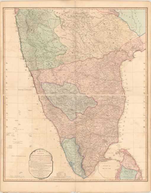
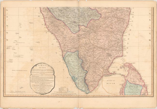
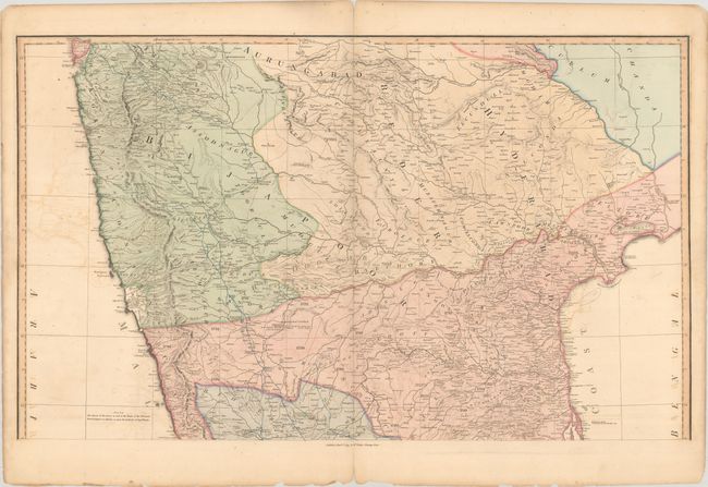
This impressive large-scale map illustrates a period when the British were consolidating their rule through various alliances with Indian kingdoms. The map, printed on two large sheets, covers the Indian subcontinent from Bombay (Mumbai) and Aurungabad, south to include the northern half of Sri Lanka (Ceylon). The routes of various military campaigns are highlighted in various colors and include the 1784 march of British Prisoners from Condapoor to Madras, the march of the Marquis of Cornwallis, the march of General Medows, and the march of General Abercromby. The acquisitions of the British and her Allies the Nizam and the Marhattas by the Partition Treaties of 1792 and 1799 vividly illustrate the growing domination of the East India Company. Compiled chiefly from papers communicated by the late Sir Archd. Campbell, the surveys of Col. Kelly, Capt. Pringle, Capt. Allan, etc. This is the third edition, first issued in 1793 and updated to 1800. The dimensions given are for each sheet; if joined, the map would measure 32.1 x 38.8".
References:
Condition: B+
Full contemporary color with offsetting, minor toning, and some small chips and tears along the edges of the sheets. The first image is a composite image - the map is in two separate sheets.