Subject: World
Period: 1696 (circa)
Publication:
Color: Hand Color
Size:
20.8 x 14.8 inches
52.8 x 37.6 cm
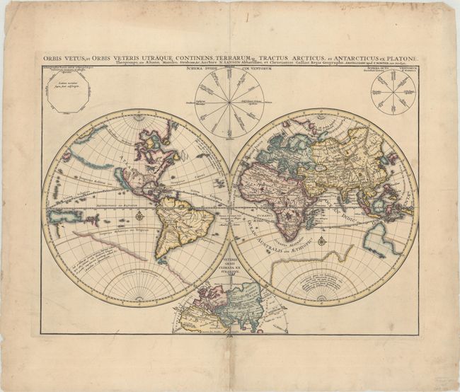
This handsome and very uncommon double-hemisphere world map is a close copy of Sanson's map that was first published in 1665 and updated through 1694. The map depicts the ancient world within a contemporary outline of the world, with classical place names in the eastern hemisphere, and just a few mythical place names in the western hemisphere. The Americas are labeled Atlantis Insula Platoni. The island of California appears beneath a vast, blank, and vaguely defined northwestern landmass. The Great Lakes are open-ended, and there are spurious mountains and rivers throughout the western hemisphere. A partially delineated outline of a large Antarctic continent fills the southern hemisphere and features a quote from Marcus Manilius' Astronomica, the earliest known treatise on astrology. Australia, New Zealand, and what appears to be part of New Guinea or the Solomon Islands are also partially delineated and unnamed. French cartography from the mid-17th to mid-18th centuries ignored the findings of Dutch explorers and instead incorporated imaginary and misleading representations of Australia and New Zealand. Mortier's edition adds a small map of the ancient world at bottom center, as well as three diagrams of wind roses at top.
References:
Condition: B+
A nice impression with light soiling and archival repairs to a number of separations and tiny tears along the centerfold.