Subject: Ancient World
Period: 1660 (circa)
Publication:
Color: Hand Color
Size:
20 x 15.5 inches
50.8 x 39.4 cm
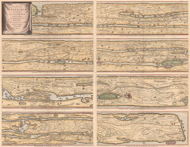
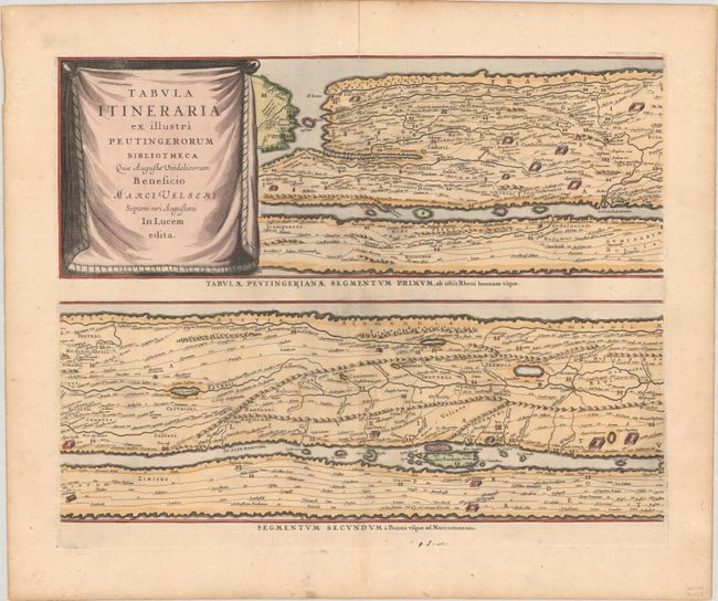
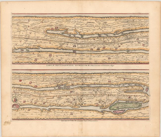
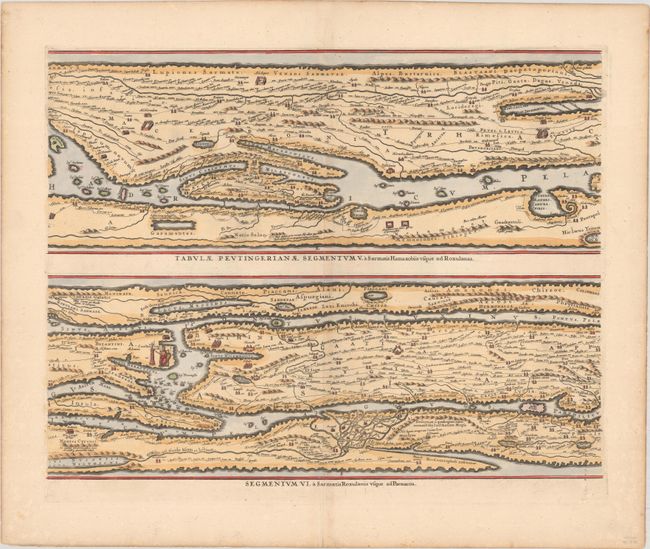
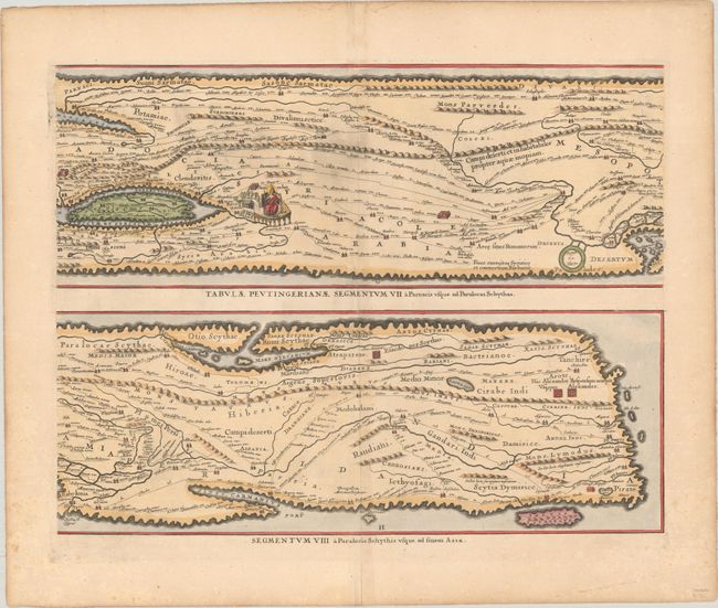
Four sheets making up the famous Peutinger Table, or a Roman road map of the world. The original parchment document was found by Konrad Celtes in a library in Augsburg, came into the hands of Konrad Peutinger and later went to his relative Mark Welser who was the first to publish a copy of it in 1591 at Aldus Manutius in Venice. These maps, based on the original manuscript, were first popularized by Ortelius in 1598 and became an important part of his great historical atlas. Jansson's version is nearly identical to that of Ortelius. These decorative maps, in a sequence of four plates, each with two strip maps, depict the imperial roads and posts within the Roman Empire throughout Europe, North Africa and Asia as far as Toprobana (Sri Lanka). Blank versos.
References: Shirley #393; Van der Krogt (Vol. I) #0940/1-4:1.
Condition: A
Very crisp impressions with marginal soiling and centerfold separations that have been archivally repaired and are confined to the blank margins. The first image is a composite image - the map is in four separate sheets.