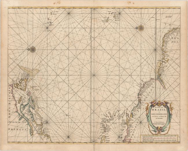
Subject: Western Atlantic
Period: 1672 (circa)
Publication: De Zee-Atlas of Water-Waerelt
Color: Hand Color
Size:
21.3 x 17 inches
54.1 x 43.2 cm
This is the second state of Doncker's rare sea chart of the Atlantic. It shows the area from Newfoundland to the northern coast of South America and across to the Azores and the Cape Verde islands in an unusual configuration, derived from the Theunisz Jacobsz chart of 1650, with north oriented to the left. Long Island is named as Gebroken Lant, and New England is named as Nieu Nederland, with no indication of the English colonial presence. The map is crisscrossed by rhumb lines and is adorned with two compass roses and a strapwork title cartouche. There are three distance scales below the title cartouche.
References: Burden #338.
Condition: B+
A crisp impression on a double-thick sheet as was common for sea charts of the period. There is light soiling and a centerfold separation that enters 1.5" into map image at bottom and has been closed on verso with archival tape.


