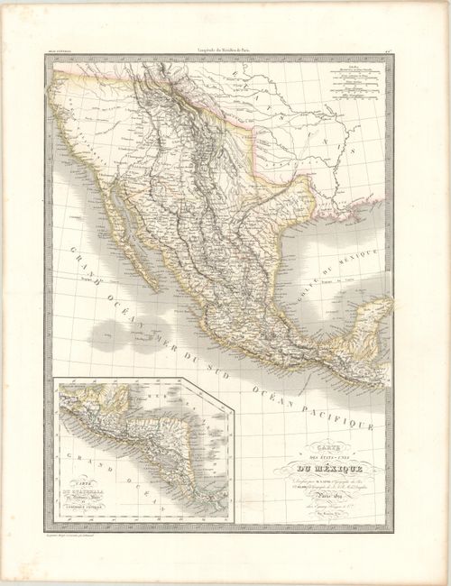
Subject: Southwestern United States, Mexico & Central America
Period: 1829 (dated)
Publication: Atlas Universel
Color: Hand Color
Size:
15.6 x 21.3 inches
39.6 x 54.1 cm
This attractive French map shows the Southwestern United States through Mexico to the Yucatan, with an inset of Central America at bottom left. Texas is named but is depicted as the Mexican province of San Luis Potosi. The Rocky Mountains are well delineated by hachure and incorporate information from Humboldt, Pike, and Long. The American West reflects cartography that predates Fremont and Smith’s explorations, including two Salt Lakes (Timpanogos and Teguayo) and the mythical rivers that connect them to the Pacific. The Lapie map was probably based upon Brue’s earlier map of the same area, and it contains similar roads, settlements, and topography. Engraved by Lallemand.
References:
Condition: A
On a bright sheet with one tiny hole adjacent to the title and some minor foxing in the margins.