Subject: Los Angeles, California
Period: 1953 (dated)
Publication:
Color: Printed Color
Size:
46.3 x 65.5 inches
117.6 x 166.4 cm
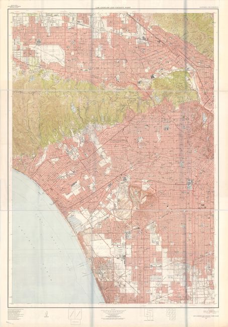
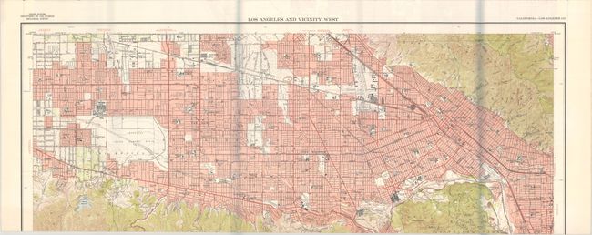
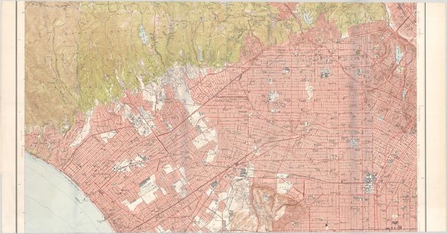
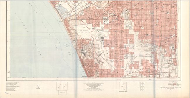
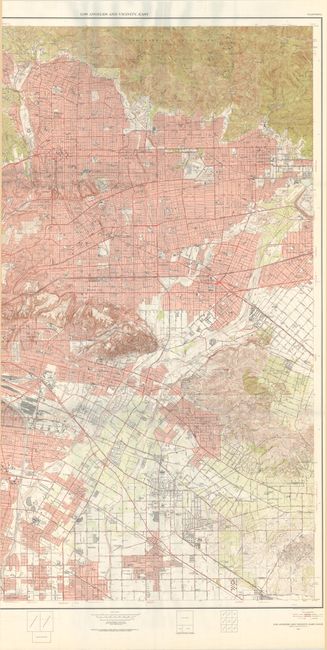
These two mammoth sheets encompass the entirety of the Los Angeles region, providing a remarkably detailed snapshot of the city in the 1950s on a scale of 1:24,000. When combined, the map measures an astonishing 7.5 feet by 5.5 feet.
A. Los Angeles and Vicinity, West (46.3 x 65.3"). This western half extends from the San Fernando Valley south to Manhattan Beach and east to Los Angeles. Presents excellent detail of the street grids of the various municipalities and nice topographical features of the Santa Monica Mountains. Locates the oil refineries south of El Segundo, Hollywood Park, Universal Studios, Warner Brothers, Disney Studios, and much more.
B. Los Angeles and Vicinity, East (45.7 x 65.3"). This eastern sheet extends from Altadena and Monrovia south to Whittier and Compton. Shows the street grid pattern, railroads, and the Los Angeles Aqueduct. The rugged topography of the Angeles National Forest and San Rafael Hills is well developed. Locates Cal Tech, the Huntington Library, Rose Bowl, Santa Anita, and more.
During the 1950s the USGS published a series of “Metropolitan Area Maps” printed in five colors on a scale of one inch equals 2000. The map series included the latest survey data for 58 metropolitan areas and showed remarkable detail. The maps today provide a snapshot of post-war American metropolitan areas before most entered a period of accelerated growth.
References:
Condition: A+
Remarkably clean and bright examples that have been folded with no tears or separations. Please note that the first image of western Los Angeles has been digitally merged and is a composite of image #2, 3 and 4 (use these smaller scans for zooming). The image of eastern Los Angeles (image #5) captures approximately 3/4 of the full map with the western edge not scanned due to size limitations with our scanner. The gray lines on the images are caused by our scanner and are not present on the physical map.