Subject: Colonial New England United States
Period: 1764 (published)
Publication: Le Petit Atlas Maritime
Color: Black & White
Size:
14.7 x 12.6 inches
37.3 x 32 cm
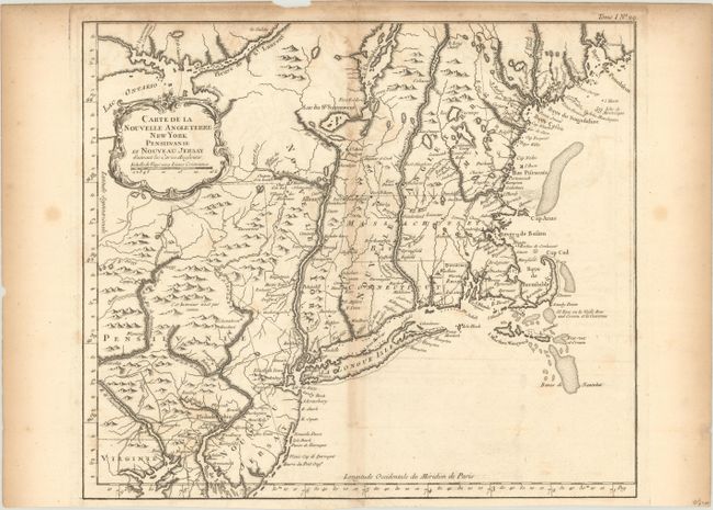
This is the larger version of Bellin's map of New England with cartography taken from Moll. This is not to be confused with the smaller, more common map of nearly the same title. The map shows the area from Penobscot Bay in Maine down to Little Egg Harbor (Havre du Petit Oeuf) in New Jersey and a bit of Delaware Bay, and extends west to Lake Ontario. Cape Cod is shown as an island, and Martha's Vineyard is named Martha's Wineyard. The map is finely engraved and filled with place names both along the coast and inland, including Casco Bay, Cape Porpoise, Cape Anne, Boston, Providence and many more. Adorned with a rococo-style title cartouche.
References: McCorkle #764.1; Sellers & Van Ee #723 & 764; Mickwitz & Miekkavaara #10:I [29]; Tooley (MCC-96) #829.
Condition: B
Issued on watermarked paper with light toning along the centerfold and sheet edges and some faint offsetting. Issued folding with some tape reinforcement on verso.