Catalog Archive
Auction 183, Lot 335

"[Lot of 2] Parte Settentrionale del Regno d'Inghilterra Descritto, e Dedicato... [and] Parte Meridionale...", Coronelli, Vincenzo Maria

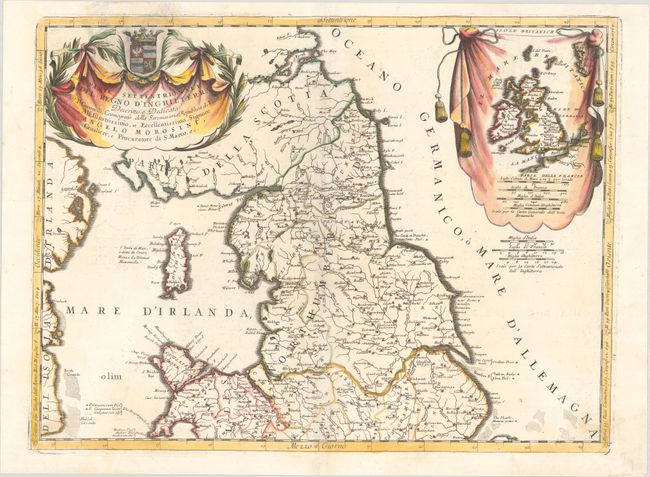
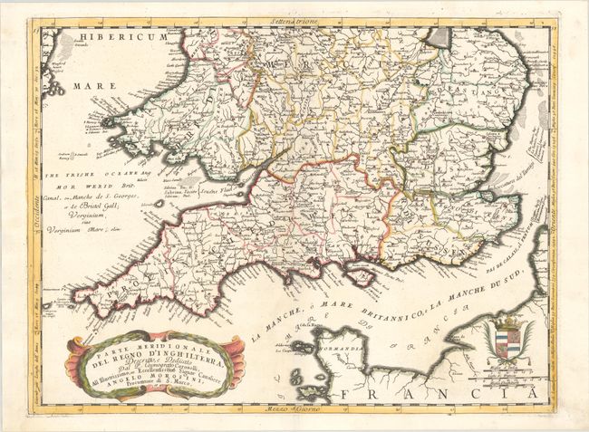
Subject: England & Wales

Period: 1692 (circa)

Publication: Corso Geografico Universale...

Color: Hand Color

Size:
23.9 x 18.1 inches
60.7 x 46 cm
Download High Resolution Image
(or just click on image to launch the Zoom viewer)

This bold and beautifully engraved set of two maps covers the northern and southern portions of England and Wales, each with decorative cartouches and coats-of-arms. Detail includes counties, towns, rivers, islands, etc. The counties are grouped into the seven ancient Anglo-Saxon kingdoms. The northern sheet includes a large inset map of the British Isles enclosed in a drape-style cartouche.

References: Shirley (BI to 1750) Coronelli 2; Shirley (BL Atlases) T.CORO-8a #23 & 24.

Condition:

Crisp impressions on sturdy paper, with a watermark on the northern sheet. There is a chip in the title cartouche of the northern sheet that has been professionally repaired with the coat-of-arms replaced in facsimile. (B) The southern sheet has minor soiling and offsetting. (A)

Estimate: $550 - $700

Unsold

Closed on 6/9/2021

Archived