Subject: Arkansas
Period: 1867-1916 (circa)
Publication:
Color:
Railroad development in Arkansas primarily took place post-Civil War and is largely the result of massive federal land grants. The land grant railroads sold the land to finance and build their railroads and encouraged immigration and settlement throughout the state. The following maps illustrate this significant period of development.
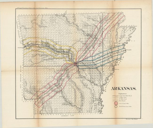
A. Arkansas, by General Land Office, from Annual Report of the General Land Office (39 Congress, 1st Sesson), published 1867, hand color (15.9 x 14.0"). This map illustrates the three major railroad land grants, creating a huge ‘X’ through the state. Federal railroad grants resulted in these companies (the Cairo & Fulton, Memphis & Little Rock, and Little Rock & Fort Smith) possessing nearly three million acres of Arkansas land. Condition: Issued folding with light toning along the folds and some short splits at fold intersections. The map has been professionally backed with Japanese tissue. (B+)
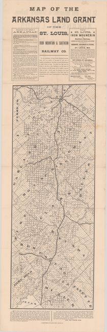
B. Map of the Arkansas Land Grant of the St. Louis, Iron Mountain & Southern Railway Co., by A. Gast & Co., circa 1880, black & white (9.3 x 24.6"). This folding strip map shows the lands available within the land grant. The map continues on the verso (9.3 x 30.6"). The text outlines the purchase and discount terms with good farming land from $3 to $5 per acre. With text, map measures 9.3 x 35.0". Condition: Issued folding with a few short fold separations and some minor scattered foxing. (B+)
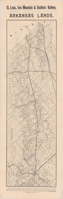
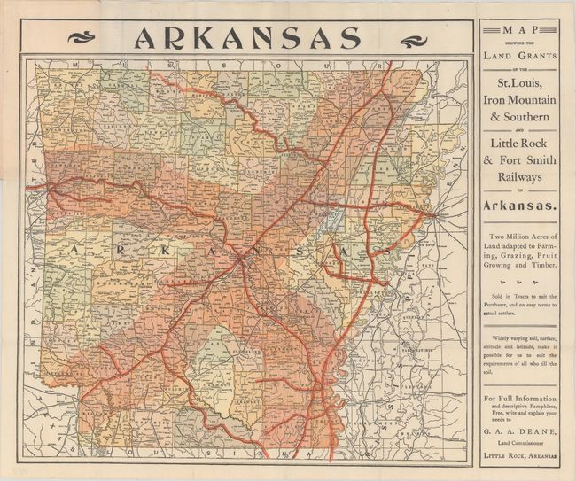
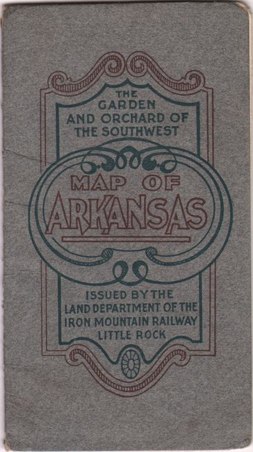
C. Map Showing the Land Grants of the St. Louis, Iron Mountain & Southern and Little Rock & Fort Smith Railways in Arkansas, by the Land Department of the Iron Mountain Railway, circa 1885, printed color (13.5 x 13.1"). This interesting map of Arkansas depicts the land grants of the St. Louis, Iron Mountain and Southern, and Little Rock and Fort Smith routes. The routes themselves are show in dark red with the land grants depicted in a lighter shade. The text states that two million acres of Arkansas have been adapted to farming grazing, fruit growing and timber and that the land is sold in tracts to suit the purchaser. Folds into paper covers titled, “The Garden and Orchard of the Southwest – Map of Arkansas” and on back “Steer for Arkansas via the Iron Mountain Route.” Map verso is stamped with an ad for C.M. Pierce, Locating and Imigration [sic] Agent. Condition: A clean and bright map issued folding on paper with a watermark that reads "Apollo." Paper wrappers have minor wear and a small spot on the back cover. (A)
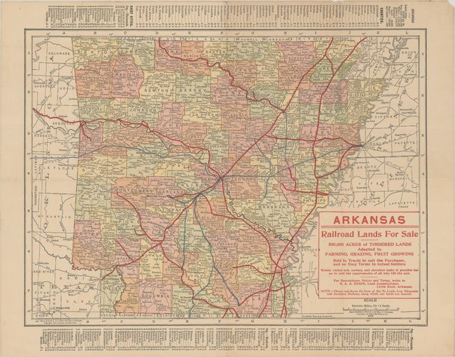
D. Arkansas – Railroad Lands For Sale, by Rand McNally & Co., dated 1913, printed color (12.4 x 9.2"). Railroads are boldly printed in red and blue over a standard atlas map. The map folds and evidently was part of a land promotion packet. Condition: Issued folding with a few tiny splits at fold intersections and some faint toning. (A)
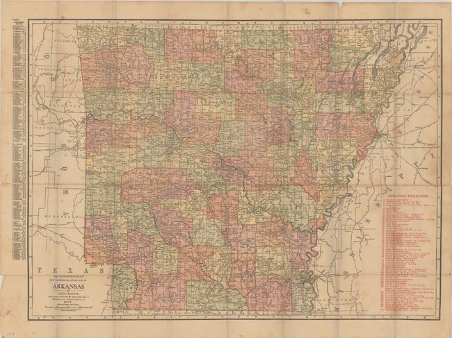
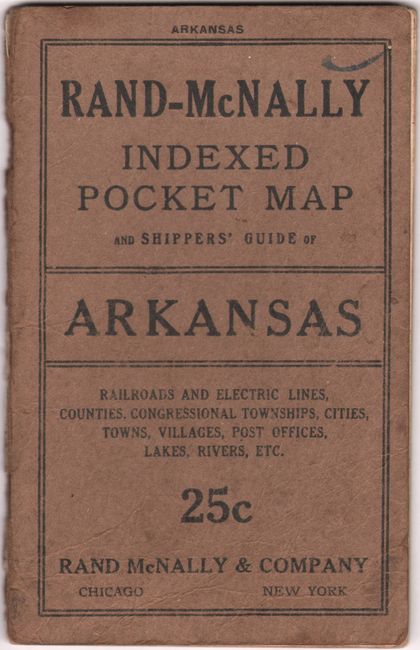
E. The Rand-McNally New Commercial Atlas Map of Arkansas, by Rand McNally & Co., published 1916, printed color (25.6 x 18.8"). The map is a pocket edition of Rand McNally’s New Commercial Atlas map with a table of railroads printed in red and keyed to the map, showing service throughout the state. It originally folded into a 58 pp. booklet titled Rand-McNally Indexed Pocket Map and Shippers' Guide of Arkansas that provides information on railroads, electric lines, post offices, express, telegraph, and mail service. Condition: The map was issued folding and has several fold separations that have been repaired on verso with archival tape. There is some light soiling and toning. The booklet has some minor dampstaining in the text. Covers are lightly worn with a partially separated spine. (B)
References:
Condition:
See description avbove.