Subject: Northeastern China
Period: 1693 (circa)
Publication: Corso Geografico Universale...
Color: Black & White
Size:
23.4 x 17.6 inches
59.4 x 44.7 cm
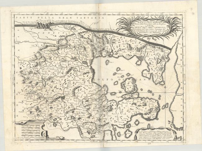
This splendid map of Xantung and Peking (comprising the present-day provinces of Hebei, Liaoning, and Shandong) comes from a set of six maps showing thirteen Chinese provinces. It was based on the Blaeu/Martini map, but was rendered in Coronelli's unique, flourishing style with mountains, forests, lakes, rivers and towns all graphically depicted and embellished with large title and scale cartouches. The map locates Beijing and Tianjin, and Jesuit missions are noted with the initials "IHS." It also features a fine illustration of the Great Wall below the top border. Vincenzo Coronelli was a Franciscan priest and renowned mathematician and cartographer. He was appointed official Cosmographer to the Venetian Republic in 1685 and founded the world's earliest geographic society, L'Accademia Cosmografica degli Argonauti.
References: Phillips (Atlases) #5951-151.
Condition: B
A dark impression on a watermarked sheet with a complete centerfold separation that has been rejoined on verso with archival materials. There is faint dampstaining at lower left and right. The shadow along the centerfold is caused by our scanner and is not on the physical map.