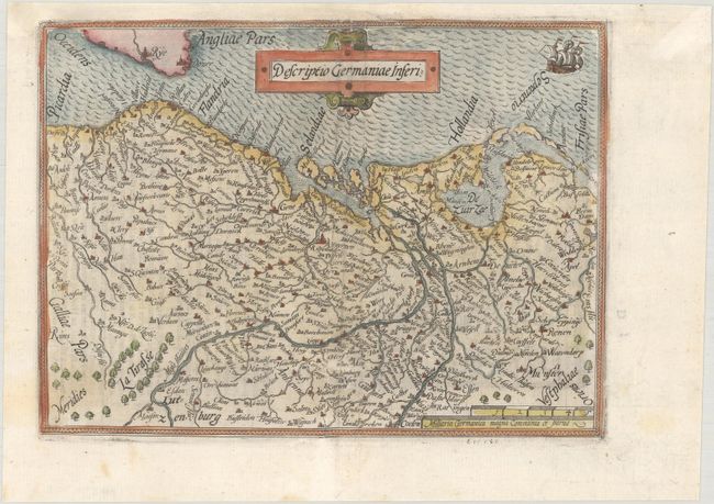
Subject: Low Countries
Period: 1579 (published)
Publication: Le Miroir du Monde
Color: Hand Color
Size:
8.3 x 6.1 inches
21.1 x 15.5 cm
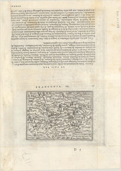
This is a reduced-sized edition of Ortelius' map of The Netherlands, Belgium and Luxembourg. Although it is nearly identical cartographically, Galle has dispensed with Ortelius' oval strapwork border and other decorative elements, opting for a simple rectangular shape with one ship and a strapwork cartouche. On verso is a miniature map of the Main River valley, Franciae Orientalis (vulgo Granckenlant) Descriptio, which is oriented with north at bottom and Frankfurt am Main is located at far right.
This map is from the first pocket-sized atlas, Spieghel der Wereld, which was based on Ortelius' Theatrum Orbis Terrarum. The maps were engraved on copper by Filips Galle and represented all regions around the world. The maps were accompanied by text prepared by Peter Heyns, who used the text from the Theatrum. The numbers printed above the maps, adjacent to the letterpress title, indicate the number of the map within the Theatrum. This innovative, small atlas was designed to reach the lower middle class, and was a commercial success, prompting numerous reprints and imitations. The first edition of the Spieghel der Wereld was published in 1577, with subsequent editions published in French in 1579 and 1583, Dutch in 1583 and 1596, and Latin in 1585. One unique feature of this pocket atlas was the inclusion of 6 larger, fold-out maps of the world, Europe, France, Germania, the Low Countries and Italy that were included alongside 66 miniature maps.
References: King (2nd Ed.) pp. 60-61; Van der Krogt (Vol. III) #3000:331 & #2550:331.
Condition: B+
A crisp impression on a bright sheet. There are professional repairs to a short centerfold separation at bottom and a few worm tracks along the centerfold, including two large ones just above the title with small portions of the image replaced in facsimile. The map has been professionally remargined at top along the binding edge.