Subject: Southern United States
Period: 1806 (circa)
Publication: Voyages dans l'interieur de la Louisiane...
Color: Hand Color
Size:
26.6 x 16.1 inches
67.6 x 40.9 cm
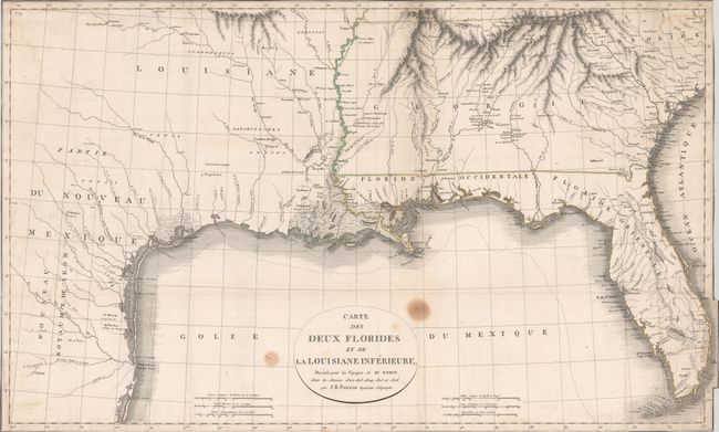
This uncommon map of the southern United States was issued in Claude Robin's Voyages dans l'interieur de la Louisiane. It was issued during a time of rapid political change in the region, and Robin witnessed first-hand the transfer of Louisiana from the French to the United States at both New Orleans and Nachitoches. Cartographically, Georgia extends to the Mississippi River and East and West Florida exist as separate territories. There is limited detail west of the Mississippi River with a few settlements and Indian villages noted along the river systems including Taejas, Cenis, and St. Antoine de Bexar. Engraved by Tardieu.
References: Howes #R-362; Sabin #72039.
Condition: B
Issued folding on watermarked paper and now flattened and backed with tissue. Trimmed to the border all around with a few worm tracks along the lower border and two stains adjacent to the title cartouche.