Subject: China
Period: 1760 (circa)
Publication:
Color: Black & White
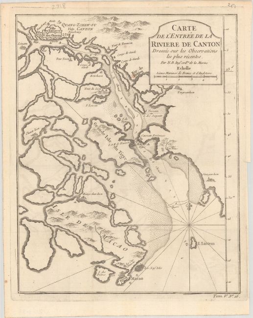
A. Carte de l'Entree de la Riviere de Canton... (8.1 x 10.2"). This copper engraved map centers on the mouth of the Canton River with the island of Macao and the future site of Hong Kong, here called Sinn-gan-hien. The fortified city of Canton is divided into Tartar and Chinese districts. Soundings and anchorages are shown and the map is decorated with a cartouche, rhumb lines, and fleur-de-lis. "Tom. V. No. 16" at lower right outside neatline.
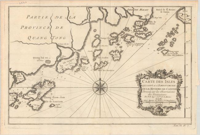
B. Carte des Isles qui sont a l'Embouchure de la Riviere de Canton... (12.5 x 8.1"). This map shows nice detail of the islands off the coast of Southeastern China including Macao. There are numerous soundings noted with a large compass rose, rhumb lines and a decorative cartouche. "Tom. VI. No. 7" at lower right outside neatline.
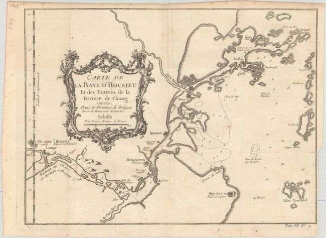
C. Carte de la Baye d'Hocsieu et des Entrees de la Riviere de Chang... (10.9 x 8.0"). This lovely chart covers the mouth of the Chang River in the vicinity of Foochow in the Fokien Province. It shows the city, bridge, forts, villages and soundings in the Bay. Adorned with decorative title cartouches in the flourishing French style.
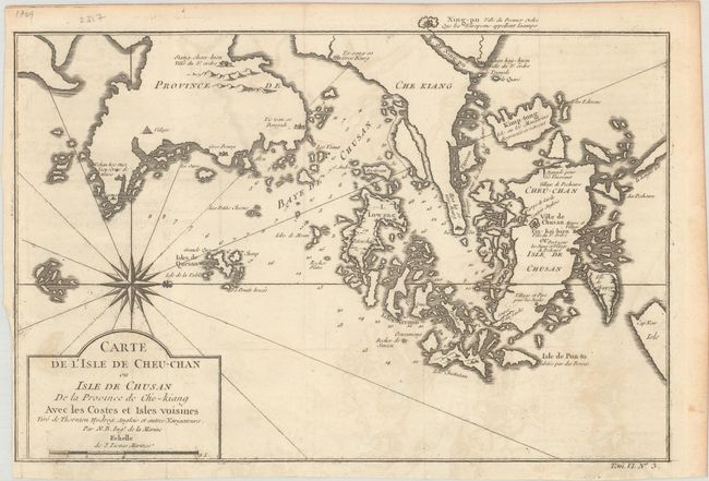
D. Carte de l'Isle de Cheu-Chan ou Isle de Chusan de la Province de Che-kiang avec les Costes et Isles Voisines... (12.5 x 8.5"). This detailed map portrays the coastal area east of Ningbo in the Chinese province of Chekiang, located across the bay from Shanghai. The ornate title cartouche with a large compass rose orients the map with north to the right.
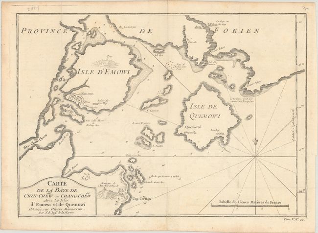
E. Carte de la Baye de Chin-Chew ou Chang-Chew avec les Isles d'Emowi et de Quemowi... (11.9 x 8.3"). This map depicts the bay of Changchow in the province of Fukien with details of the coastline, soundings, navigation hazards, forts and villages.
References:
Condition: A
Issued folding on watermarked paper with a hint of offsetting and a few minor spots.