Subject: Eastern Mediterranean & Middle East, Persia
Period: 1766-80 (circa)
Publication:
Color: Hand Color
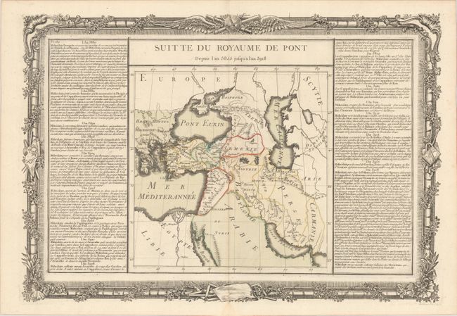
A. Suitte du Royaume de Pont Depuis l'An 3855 Jusqu'a l'An 3918, by Brion de la Tour/Desnos, circa 1766 (20.5 x 14.1"). This handsome historical map covers from Greece to Persia, extending to include the Nile Delta, part of the Arabian Peninsula, and the Black and Caspian seas. It includes several ancient place names and political divisions. There is no sign of Crete or Cyprus. The map is flanked by French text discussing the history of the region in the 39th and 40th centuries BCE. It is surrounded by an ornate frame-style border that was printed from a separate plate. Condition: A crisp impression with contemporary color on watermarked paper with minor color offsetting along the centerfold, and a small damp stain confined to the bottom blank margin.
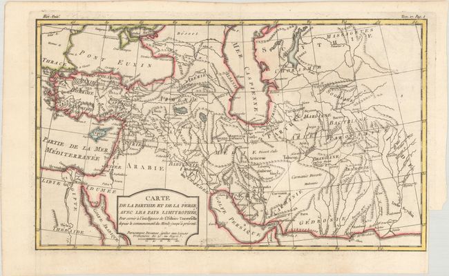
B. Carte de la Parthie et de la Perse, avec les Pays Limitrophes, pour Servir a l'Intelligence de l'Histoire Universelle Depuis le Commencement du Monde Jusqu'a Present, by Louis Brion de la Tour, from Histoire Universelle, circa 1780 (13.4 x 7.9"). This map of the Persian Empire spans from Turkey to the Indus River. It features good topographical detail of the region's rivers and mountains and includes some place names. Condition: Issued folding on watermarked paper with a hint of offsetting and a binding trim in the right margin.
References:
Condition: A
See description above.