Subject: Eastern Massachusetts
Period: 1874 (dated)
Publication:
Color: Black & White
Size:
27.2 x 37.6 inches
69.1 x 95.5 cm
The Office of Coast Survey is the oldest U.S. scientific organization, dating from 1807 when Congress directed that a "survey of the coast" be carried out. By 1836, it was called the U.S. Coast Survey and in 1878, the name was changed to the U.S. Coast and Geodetic Survey. Today the Office of Coast Survey is a division of the National Oceanic and Atmospheric Administration NOAA.
The survey teams, composed of civilians as well as Army and Naval officers, charted the nation's waterways and produced a wide array of reports, survey charts, hydrographic studies of tides and currents, astronomical studies and observations, and coastal pilots. These charts are an important record of the changing nature of the nation's coastlines. In additional to coastal charts, the U.S. Coast and Geodetic Survey produced land sketches, Civil War battle maps, and the early aeronautical charts.
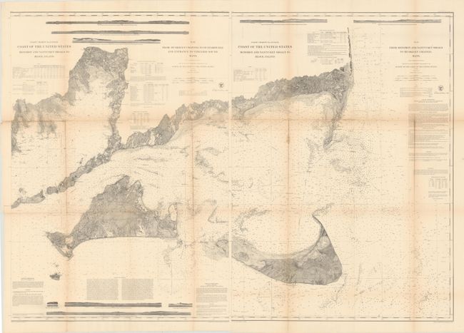
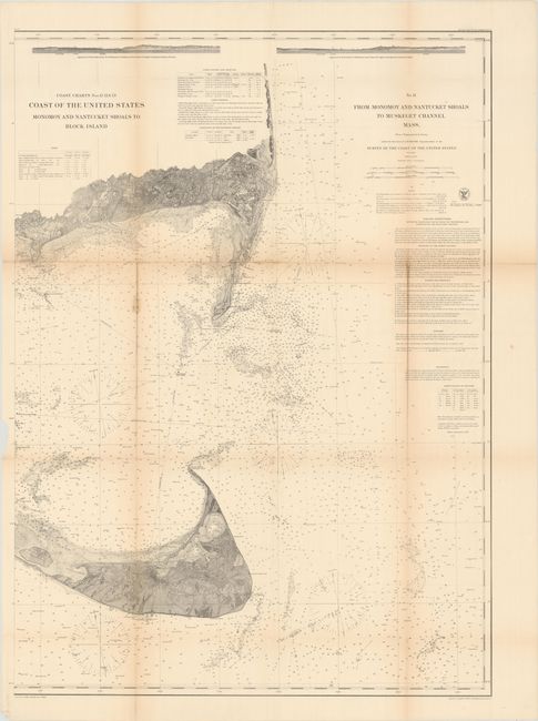
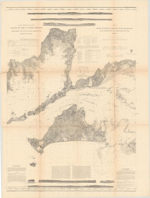
These two charts together extend from Buzzard's Bay east to Chatham, including Martha's Vineyard and Nantucket. The sheets are filled with nautical information including scores of soundings, shoals, bottom types, lighthouses, and more. There is also fine topographical detail inland, including the street-grid pattern of Chatham and Nantucket. Supplementing the charts are several coastal approaches,
sailing directions, and tables on tides, currents, lighthouses, and more. Drawn under the direction of A.D. Bache.
References:
Condition: B+
Issued folding and now flattened and backed with tissue to reinforce and repair some minor fold separations. There is light toning along the fold lines and a small repaired chip to one of the tables on sheet 12. The first image is a composite image - the map is in two separate sheets.