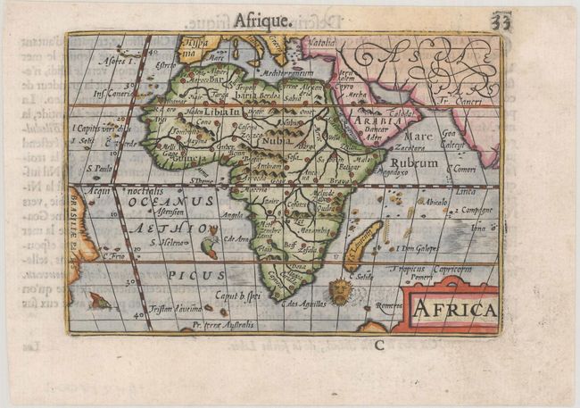
Subject: Africa
Period: 1600 (published)
Publication: Thresor de Chartes
Color: Hand Color
Size:
4.9 x 3.4 inches
12.4 x 8.6 cm
This map of Africa is interesting for its strange depiction of the Nile, which originates in a large lake south of the Equator. From this lake three large rivers flow to the seas: the Nile to the Mediterranean, the Congo to the Atlantic, and what could be the Zambeze to the Indian Ocean. Although this map is based on the Gastaldi-Ortelius and Mercator models, it includes the unique feature of a lake along the Equator into which both the two Ptolemaic lakes flow. The map is decorated with a strapwork title cartouche and three sea monsters, including a sea "lion." French text on verso.
The map was first published by Cornelius Claesz and printed by Barent Langenes in the 1598 edition of the popular Map-treasury. For the 1599 edition, graduation lines and latitude numerals were added to one side of the border on most of the maps, which were again used for multiple editions through 1650. This is from a French edition, printed by Albert Hendricks.
References: Betz #37; King (2nd ed.) pp. 80-82; Van der Krogt (Vol. III) #8600:341.
Condition: A
A nice impression on a bright sheet with a faint stain at top.