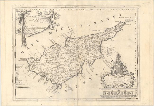
Subject: Cyprus
Period: 1690 (circa)
Publication: Atlante Veneto...
Color: Black & White
Size:
24.1 x 18.1 inches
61.2 x 46 cm
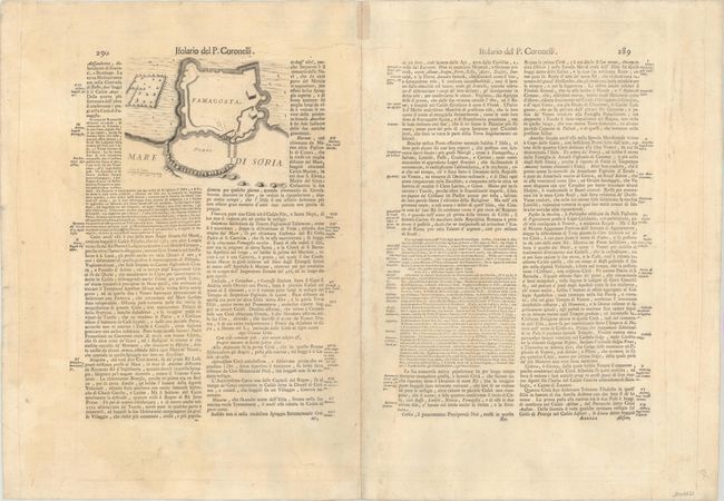
This decorative map of Cyprus was first published in Coronelli's Racolta di Tavole Geografiche in 1689 and later in the grand Atlante Veneto, which is the publication source for this example. Cartographically, the map is based upon the earlier works of Ortelius and Blaeu, though Stylianou notes that Coronelli never consulted the Giacomo Franco's map of 1570 (which was the basis for the Ortelius map). Coronelli does make updates to coastal place names as well as replacing the names of the four ancient districts with modern ones similar to those on Paolo Forlani's map. In the typical Italian style, the map is richly embellished with a title cartouche drawn on ox-hide and an elaborate cartouche surrounding the distances scales featuring numerous coats of arms. The large coat of arms surmounting the cartouche represents Jerusalem (crosses) and the House of Lusignan (lions). Italian text on verso (pages 289-90) with a small plan of Famagusta (6.8 x 5.1").
References: Stylianou #138; Zacherakis #678; Shirley (BL Atlases) T.CORO-6a #29.
Condition: B+
A nice example with faint foxing adjacent to the centerfold, minor creasing along the top border, and a small centerfold separation confined to the top blank margin that has been closed on verso with old paper. Light text show-through from verso.