Subject: Colonial Central United States
Period: 1778 (circa)
Publication: Atlante Novissimo
Color: Hand Color
Size:
16.6 x 12.5 inches
42.2 x 31.8 cm
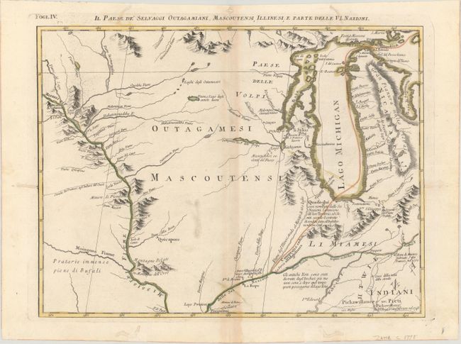
This is one sheet of Zatta's version of John Mitchell's epic and important map of the United States. The whole map was titled Le Colonie Unite dell' America Settentrle and was published as a set of twelve individual maps. This fourth sheet covers the region from Indiana north through Michigan and west to the headwaters of the Mississippi River. Michigan contains a long, spurious mountain range down its center and the Fume e Porto Chicagou (Chicago Portage) appears where the city would eventually be founded. The interior is filled with notations, numerous river systems, and some fanciful topography.
References: Sellers and Van Ee #163; Shirley (BL Atlases) T.ZAT-1a, Vol. 4 #28.
Condition: B+
A crisp impression with contemporary color on a bright sheet with a three crescent moons watermark. There is light toning along the centerfold and minor soiling. There are some worm tracks that are mostly confined to the blank margins that have been archivally repaired, with one just passing the neatline at right and two entering the title at top with a minor amount of image replaced in facsimile.