Subject: Colonial Eastern North America & West Indies
Period: 1722 (circa)
Publication:
Color: Hand Color
Size:
23.9 x 18.5 inches
60.7 x 47 cm
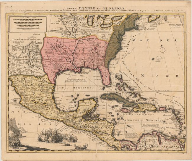
This is Schenk's scarce derivative of Guillaume Delisle's influential "Carte du Mexique et de la Floride" (1703). Despite the title, this map covers a large portion of North America from the Great Lakes through the Caribbean, with Delisle's excellent depiction of the Mississippi River Valley. The Southwest shows missions and native villages, including Acoma, depcited perched on a mesa, as well as Taos, Santa Fe, and Casa Grande. Schenk has added a vignette off the Pacific coast of Central America, reflecting the wealth of the region with an elaborate sea battle between Spanish and French forces and a scene of buccaneers unloading a treasure chest. The routes of the Spanish galleons are shown throughout the Caribbean.
References: Martin & Martin, pl #16.
Condition: B+
Full contemporary color with light offsetting. There is a very narrow strip of loss (1/16") along the bottom 2" of centerfold with only a few letters missing from place names that has been closed on verso with old paper.