Subject: Central Asia
Period: 1597 (circa)
Publication: Geographiae Universae tum Veteris tum Novae...
Color: Black & White
Size:
6.7 x 4.9 inches
17 x 12.4 cm
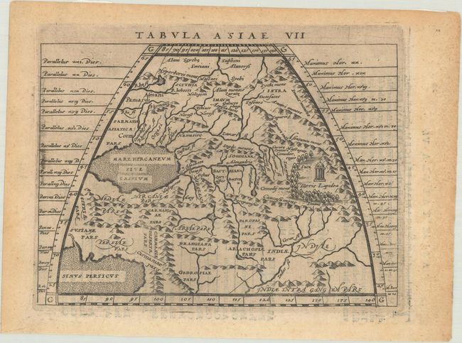
Claudius Ptolemy was a mathematician, astronomer and geographer who worked in Alexandria, then a part of the Roman Empire, in the 2nd century AD. One of the most learned and influential men of his time, his theories dominated both astronomy and geography for nearly 1500 years. His writings were kept alive by Arabic scholars during the Middle Ages and reemerged in Europe during the Renaissance. The birth of printing led to wide dissemination of his great works on astronomy and geography. There were a number of editions of his Geographia beginning in 1477. These early editions contained maps based on his original writings, known as Ptolemaic maps. As geographic knowledge increased with the explorations of Columbus, Magellan, Cabot and others, maps of the New World were added, and maps of the Old World were revised. Ptolemy's Geographia continued to be revised and published by some of the most important cartographers including Martin Waldseemuller, Sebastian Munster, Giacomo Gastaldi, Jodocus Hondius, and Gerard Mercator (whose last edition was published in 1730).
This map depicts the region east of the Caspian Sea including present-day Kazakhstan, Uzbekistan, Turkmenistan, Afghanistan, and part of Iran. Ptolemy's "stone tower," the Turris Lapidea, is depicted at right. This map was engraved by Girolamo Porro for the quarto edition of Ptolemy's Geography, which was edited by the distinguished Italian geographer Giovanni Magini. Latin text on verso.
References: Mickwitz & Miekkavaara #224-23; Shirley (BL Atlases) T.PTOL-12a.
Condition: B+
Very light toning with small remnants of hinge tape on verso.