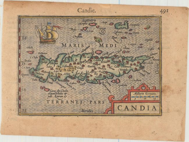
Subject: Crete
Period: 1600 (published)
Publication: Thresor de Chartes
Color: Hand Color
Size:
4.8 x 3.3 inches
12.2 x 8.4 cm
Miniature map of Crete with a good amount of detail for its size. The sea is engraved in a moiré pattern and both a large ship and a sea monster can be found north of the island. French text on verso.
The map was first published by Cornelius Claesz and printed by Barent Langenes in the 1598 edition of the popular Map-treasury. For the 1599 edition, graduation lines and latitude numerals were added to one side of the border on most of the maps, which were again used for multiple editions through 1650. This is the second state with the added graduation lines from a French edition, printed by Albert Hendricks.
References: King (2nd ed.) p. 80-82; Van der Krogt (Vol. III) #7900:341.
Condition: B+
A nice impression with light toning and minor foxing.