Subject: Western Hemisphere - America
Period: 1804 (circa)
Publication: Oskolai Magyar Uj Atlas
Color: Black & White
Size:
16.3 x 12.8 inches
41.4 x 32.5 cm
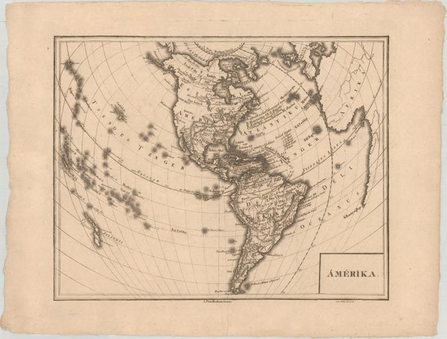
This rare Hungarian map of the Americas was prepared by Ezsaias Budai, a geography teacher at the Calvinist College in Debrecen, and was published in Oskolai Magyar Uj Atlas (Hungarian New School Atlas). The map appears to be based on French atlas maps of the period and was engraved by David Pethes, a student at the Calvinist College. Captain Cook's new discoveries are reflected in the northwest coast of North America and Alaska. The map of the Western Hemisphere shows the new United States prior to the Louisiana Purchase, with all states and territories extending to the Mississippi River. Santa Fe is located but the entire Rocky Mountain region and Pacific coast is devoid of detail. Other than Santa Fe, the only other cities named in the present-day United States are New Orleans, Mobile, Pensacola, and Monterey. The western coast is labeled Uj Albion.
References:
Condition: A
A crisp impression with a printer's crease running along the center of the map and a few faint spots.