Subject: Western Hemisphere - America
Period: 1835 (dated)
Publication: Atlas Geographique, Astronomique et Historique
Color: Hand Color
Size:
14.5 x 19.7 inches
36.8 x 50 cm
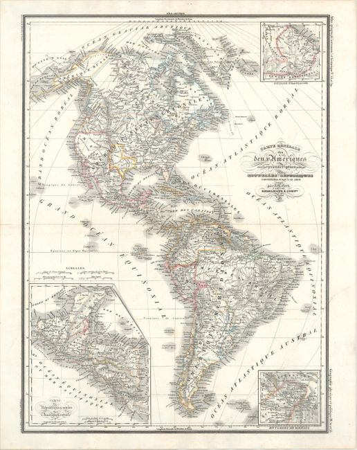
This handsome map of North and South America features an independent Republic of Texas with a large stovepipe and extending west to the Rio Grande, incorporating Albuquerque and Santa Fe. The map gives good detail of the interiors of both continents, with towns, political boundaries, mountains and rivers well defined. The northwestern portion of the United States is called Oregon Territory with numerous Indian tribes named and evidence of the Oregon Boundary Dispute along the Canadian border. Mexico encompasses the entire southwest of the U.S. In South America, Columbia encompasses Ecuador and Venezuela, and Argentina is labeled as Patagonie. Insets fill three corners of the map, depicting Central America, Guyana, and the region surrounding Mexico City.
References:
Condition: A
A bright sheet with a professionally repaired centerfold separation in the left blank margin and a few faint spots.