Subject: Northern China
Period: 1737 (circa)
Publication: Description Geographique Historique... de l'Empire de la Chine et de la Tartarie Chinoise
Color: Hand Color
Size:
21 x 18.1 inches
53.3 x 46 cm
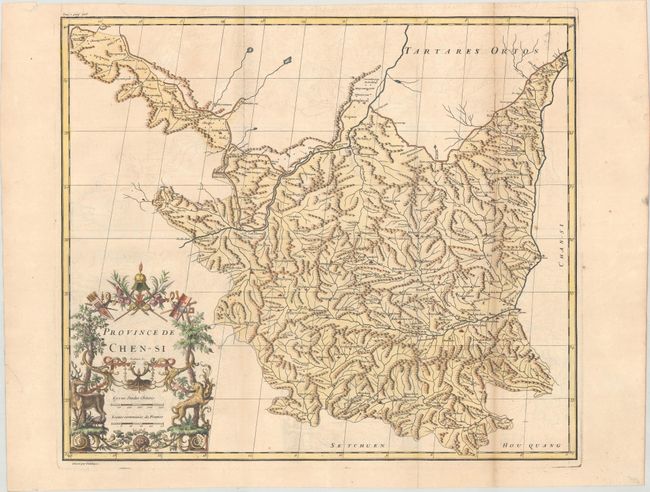
This copper engraved map details the Shaanxi province with wonderful detail of cities plus watershed and topography. The Great Wall of China and the Yellow River both meander throughout the map. Locates the cities of Singanfou (Xian), Lan-tcheou (Lanzhou), and many more, each identified by its own icon. Beautifully decorated with an elaborate Chinoise title cartouche. The maps from Du Halde's atlas were assembled by D'Anville and compiled from an extensive Jesuit survey carried out in 1708-16 for the Emperor Kang-Shi. It remained the principal cartographical authority on China during the rest of the 18th century. The missionaries used local sources and personal observation to prepare these incredibly detailed maps. Drawn by Guelard and engraved by Delahaye.
References: Shirley (BL Atlases) T.HALD-1a #12.
Condition: B+
Issued folding on paper with a large medallion watermark. There is light offsetting and toning along one of the folds at right.