Subject: Southern Netherlands
Period: 1629 (dated)
Publication:
Color: Hand Color
Size:
21.6 x 17.6 inches
54.9 x 44.7 cm
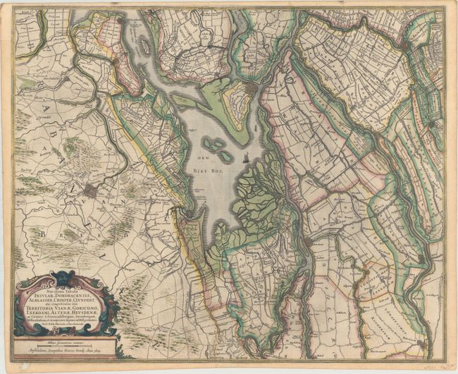
This handsome map of the southern part of the Netherlands centers on the Biesbosch National Park region. Based on the original surveys by Balthasae Florisz. Berckenrode, it features incredible detail of the roads, waterways, and topography of the region. It identifies several towns and cities, including Breda, Dordrecht, and Gouda, all shown in miniature plan form. North is oriented to the right. There is a decorative cartouche with the title and distance scale at bottom left. French text on verso, published in 1633 in either Gerardi Mercatoris et I. Hondii Atlas… or L'Appendice de l'Atlas.
References: Van der Krogt (Vol. I) #3403:1.1.
Condition: B+
A sharp impression with a couple light spots, some printer's ink residue, and a short edge tear that enters 0.5" into image at bottom center that has been closed on verso with archival materials. There is a small hole at bottom left that just touches the neatline and has also been archivally repaired.