Catalog Archive
Auction 172, Lot 350

"Land-Kaart van het Eiland en de Volkplanting van Cayenne aan de Kust van Zuid-Amerika", Tirion, Isaac

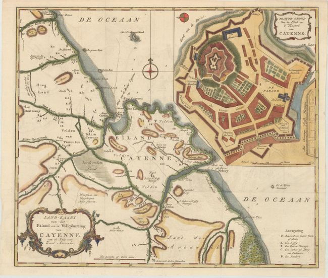
Subject: French Guiana

Period: 1769 (circa)

Publication: Nieuwe en Beknopte Hand-Atlas

Color: Hand Color

Size:
16.4 x 14.1 inches
41.7 x 35.8 cm
Download High Resolution Image
(or just click on image to launch the Zoom viewer)

An attractive and detailed map of the vicinity of Cayenne in French Guiana. The large inset at upper right is a terrific example of a fortified castle. The map locates towns, villages, churches, sugar works, and scores of plantations. Embellished with a rococo-style cartouche and a pair of compass roses.

References: Shirley (BL Atlases) T.TIR-2a.

Condition: A

A crisp impression, issued folding, on a bright sheet with faint offsetting and a minor damp stain at bottom right.

Estimate: $110 - $140

Unsold

Closed on 4/17/2019

Archived