Subject: Caribbean
Period: 1703 (circa)
Publication:
Color: Hand Color
Size:
20.2 x 22.8 inches
51.3 x 57.9 cm
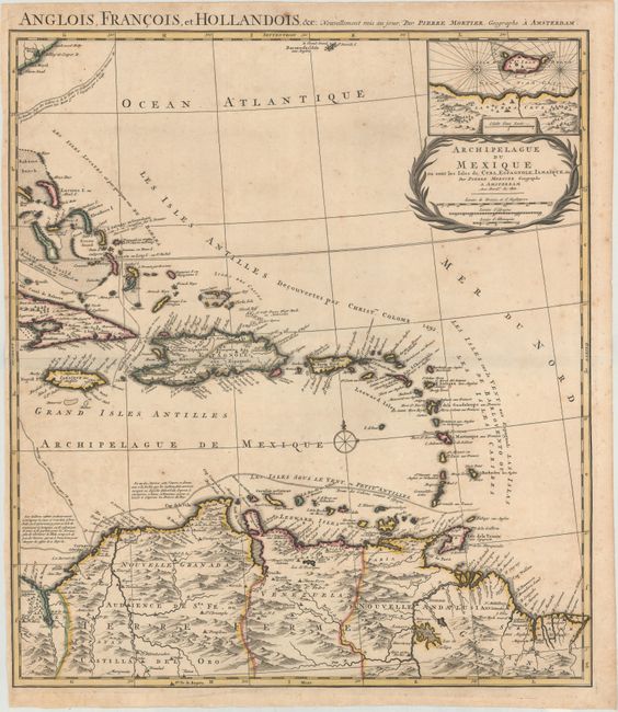
This is the eastern sheet of a two-sheet map of the Gulf of Mexico and Caribbean, extending from eastern Cuba and the Bahamas to the ABC islands and northern South America. At top right is an inset map of the region around Veracruz, Mexico. This is the first state of the map, which was created to show the theater of war in the Americas during the War of the Spanish Succession. The map identifies the colonial territories of the Spanish, British, French and Dutch. Several shipping routes are also depicted, including those from Spain to Havana, from Cartagena to Portobelo, and from Cartagena to Havana. The partial title at top is a continuation of the western sheet: Teatre de la Guerre en Amerique telle qu’elle est a Present Possedee par les Espagnols, Anglois, Francois, et Hollandois.
References: Lowery #257.
Condition: B+
A sharp impression with contemporary outline color and a few tiny cracks in Hispaniola that have been archivally backed on verso. There are are few spots of foxing, some extraneous creasing, and a short tear along the left edge of the sheet that has been closed with archival tape on verso.