Subject: United States
Period: 1845-61 (circa)
Publication:
Color: Hand Color
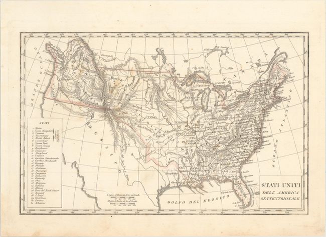
A. Stati Uniti dell' America Settentrionale, by Anonymous, circa 1845 (12.6 x 8.0"). This Italian map shows the United States just prior to Texas becoming a state. Mexico is control of the Southwest and the United States' claims in the Northwest extend well into British Columbia. The center of the country is dominated by a large Missouri Territory with many forts and Indian tribes named. Condition: Minor foxing. (B+)
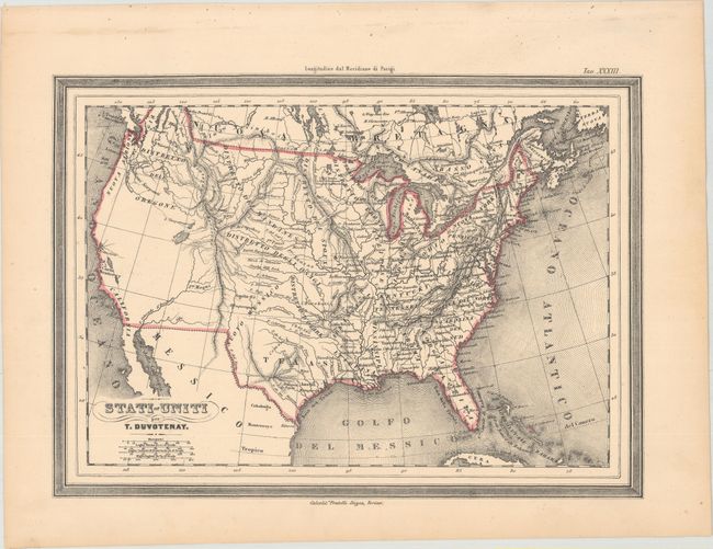
B. Stati-Uniti, by T. Duvotenay, circa 1848 (12.0 x 8.6"). This is a scarce Italian edition of Thunot Duvotenay's map of the United States lithographed by the Doyen Brothers in Turin. The map illustrates a tumultuous period in U.S. history and the confusion this caused among European publishers as they tried to keep up-to-date with the rapid political changes in North America. It shows the new state of Texas (1845) as well as the U.S. acquisition of the Southwest and California (1846-48), although it is completely void of place names. Large Indian Districts cover the area west of the Mississippi River, and the northwest shows the border well into present-day Canada, reflecting United States interests in Oregon Territory. Condition: A hint of pleasant light toning, else fine. (A)
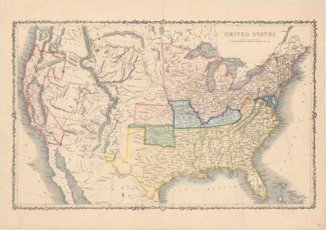
C. United States, by John Rapkin, circa 1861 (16.8 x 10.6"). Fine map covers the entire country, issued just prior to the beginning of the Civil War, which is the main focus of the map. The legend uses color to indicate Federal Non-Slaveholding States, States bordering Slaveholding States, and the Confederate Slaveholding States. Also indicates the Indian Territory with its own color. The large Washington Territory, is depicted in the short-lived inverted 'L' configuration, extending east to the Continental Divide and south to the Utah Territory. The proposed Territory of Arizona is shown in the southern part of New Mexico Territory. A huge Dakota Territory extends from Minnesota to Washington. Surrounded by a decorative vine and leaf border. An uncommon pre-Civil War issue that was published by the London Printing and Publishing Company. Condition: Issued folding. (A)
References:
Condition:
See description above.