Subject: World
Period: 1740 (dated)
Publication:
Color: Hand Color
Size:
14.8 x 9.6 inches
37.6 x 24.4 cm
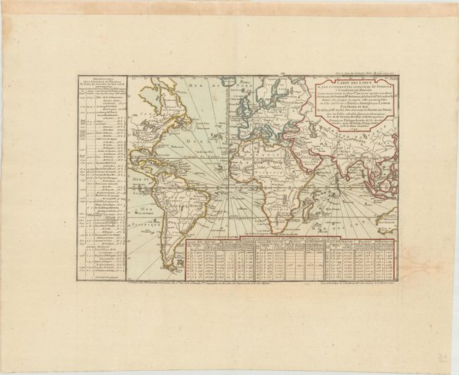
This scarce map is centered on the African continent and extends to the eastern half of North America and through Asia to include Formosa and part of Australia (New Holland). The map is drawn on Mercator's projection and at bottom and left are tables illustrating the difference in astronomical observations taken during the seventeenth and early eighteenth centuries. The bottom table gives the measurements of Newton, Bradley, and de Maupertius. The table at left gives the locations observed by numerous explorers between 1677 and 1737. Published by Dezauche, circa 1780 or later. Originally from the rare scientific work Cartes et Tables de la Geographie Physique (1754), with maps by Buache and Delisle. The first state was engraved by I. Van Duren, but this Dezauche edition gives no engraver attribution.
References:
Condition: B+
Issued folding with wide margins and a light damp stain that just enters the neatline into the table at bottom right. There are a few minor spots, and hinge tape runs across the top edge of the sheet, on recto.