Subject: Holy Land
Period: 1741 (published)
Publication: Description Exacte de l'Univers, ou l'Ancienne Geographie Sacree et Profane
Color: Hand Color
Size:
27.9 x 17.1 inches
70.9 x 43.4 cm
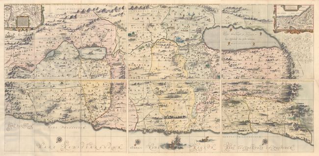
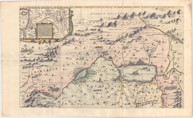
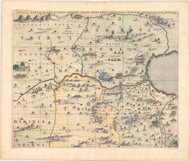
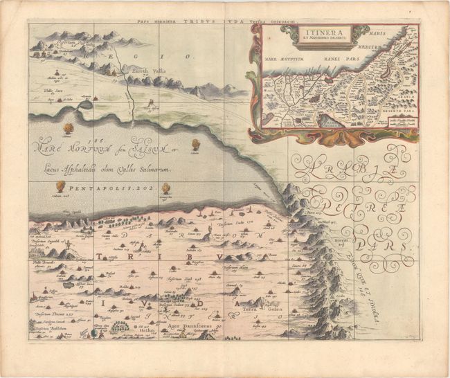
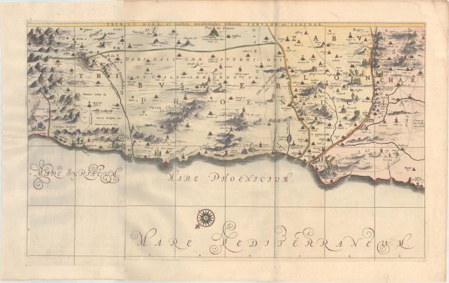
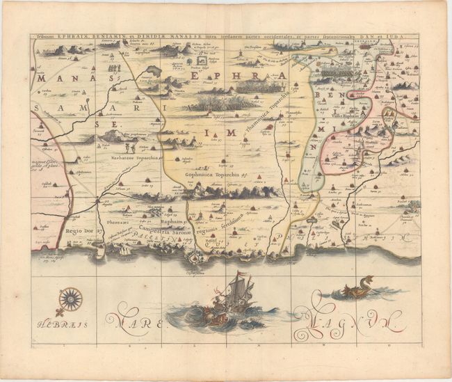
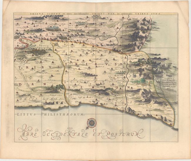
This superb, large wall map on six separate sheets is based on Adrichom's "Situs Terrae Promissionis." Oriented to the east, the map shows the region divided into the twelve tribes on both sides of the Jordan River, the shoreline running from Sidon to Alexandria. The Cison Torrens (Kishon River) is shown as connecting the Sea of Galilee with the Mediterranean Sea, and there are many nonexistent rivers, e.g., a river connecting Jerusalem with the Dead Sea. In the Dead Sea, four burning cities are shown: Sodoma, Gomorra, Seboim, and Adama. The dramatic map is beautifully engraved to show topographical features, major roads, towns and villages and richly embellished with dozens of biblical illustrations. Inset maps in the top corners depict Abraham's journey and the wandering of the Israelites through the desert. Two of the six sheets are made up of one and a half sheets joined together, resulting in the map sometimes being described as a seven-sheet map. The two left-hand sheets measure 28.1 x 16.9", and the remaining four sheets measure 21.3 x 17.1". If the sheets were joined the entire map would measure 70 x 34". Blank versos, published in Pieter de Hondt's Description Exacte de l'Univers, ou l'Ancienne Geographie Sacree et Profane, a French edition of Georgius Hornius' Accuratissima Orbis Antiqui Delineatio, which included maps from Johannes Jansson's historical atlas and Abraham Ortelius' Parergon.
References: Laor #343-349; Van der Krogt (Vol. I) #8150:1D.
Condition: A
Sharp impressions on clean sheets with a few minor extraneous creases and light toning along the edges of the sheets. Tribuum Ephraim has a few minor spots of foxing at bottom and Tribus Simeon has some printer's ink residue in the left blank margin. There are grayish shadows on the Tribus Aser and Tribus Simeon sheets that are caused by our scanner and do not appear on the maps themselves. The first image is a composite image - this map is in 6 separate sheets.