Subject: Central Italy
Period: 1730 (published)
Publication:
Color: Hand Color
Size:
24.2 x 17.7 inches
61.5 x 45 cm
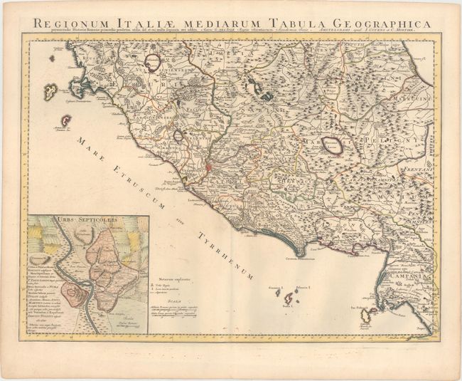
This handsome map of central Italy is roughly centered on Rome, and extends from Lake Bolsena and the town of Spoleto in the north, to Naples in the south. The map is filled with details of towns, an extensive road system, political boundaries, aqueducts, rivers, and mountains. Fucinus Lacus (Fucine Lake), which was drained in 1875, is prominently depicted east of Rome. At bottom left is an inset of the Seven Hills of Rome to the east of the Tiber River, with the Vatican Hill and the Janiculum Hill to the west.
References:
Condition: B+
A nice impression with original color in the map and later color in the inset. There are some tiny ink spots in the bottom portion of the sheet.