Subject: Colonial North America
Period: 1707 (circa)
Publication: Atlas Nouveau et Curieux des Plus Celebres Itineraires...
Color: Hand Color
Size:
12 x 7.9 inches
30.5 x 20.1 cm
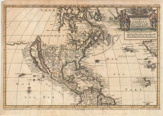
This charming map depicts a large island of California separated from Terra Esonis by the Strait of Anian. The Northwest coast is completely blank above the peninsula labeled Aqubela de Cato. The Great Lakes are shown with lakes Michigan and Superior open-ended, and in the West the Rio del Norte emanates from a large inland lake and flows into the sea between the mainland and California. The title cartouche is adorned in a military theme with a portrait of Christopher Columbus. This is the second state with the French title running underneath the map: L'Amerique Septentrionale, avec sa Terre Ferme et les Antilles...
References: McLaughlin #172; Tooley (Amer) p. 129, #75.
Condition: B+
A dark impression, issued folding on watermarked paper with light offsetting and minor toning. There is a 0.5" fold separation near the center of the map and a 0.5" edge tear entering the border at right that have both been repaired on verso with archival tape.