Subject: Washington, D.C.
Period: 1876 (dated)
Publication:
Color: Printed Color
Size:
20 x 15.9 inches
50.8 x 40.4 cm
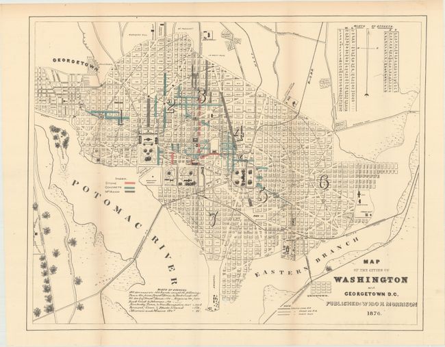
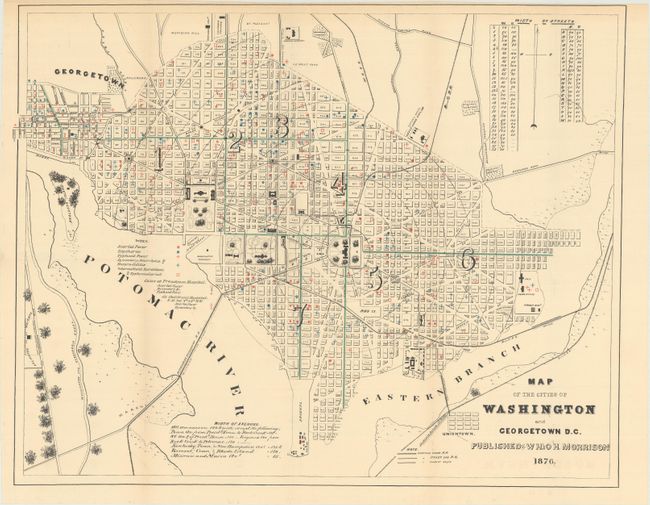
These two thematic maps were issued in a report of the Commissioners of the District of Columbia. Beginning in the early 1870's, population growth exploded and the city lacked the basic infrastructure to support it. In 1874, Congress created a three-person Board of Commissioners to become the permanent government for the District. Over the next several decades, much was done by the Commission to improve living conditions and infrastructure including paved roads, new water lines, and upgraded sewer capacity. These maps reflect the early stages of those efforts. The first map includes overprinting to identify those streets that were replaced with stone, concrete and Macadam. The second map shows instances of diseases including scarlet fever, diphtheria, typhoid fever, and more caused in part to the unsanitary living conditions. Published by W.H. & O.H. Morrison.
References:
Condition: B+
Issued folding with light toning. The first map has a tiny hole at bottom adjacent to the Arsenal.