Catalog Archive
Auction 169, Lot 206

"Il Paese de' Selvaggi Outagamiani, Mascoutensi, Illinesi, e Parte delle VI. Nazioni", Zatta, Antonio

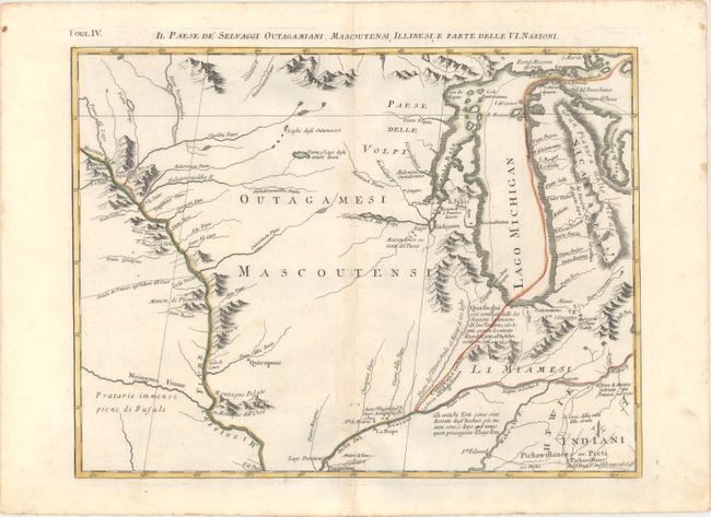
Subject: Colonial Upper Midwestern United States

Period: 1778 (published)

Publication: Atlante Novissimo

Color: Hand Color

Size:
16.5 x 12.4 inches
41.9 x 31.5 cm
Download High Resolution Image
(or just click on image to launch the Zoom viewer)

This is one sheet of Zatta's version of John Mitchell's epic and important map of the United States. The whole map was titled Le Colonie Unite dell' America Settentrle and was published as a set of twelve individual maps. This fourth sheet covers the region from Indiana north through Michigan and west to the headwaters of the Mississippi River. Michigan contains a long, spurious mountain range down its center and the Fume e Porto Chicagou (Chicago Portage) appears where the city would eventually be founded. The interior is filled with notations, numerous river systems, and some fanciful topography.

References: Sellers and Van Ee #163.

Condition: A

Original outline color on watermarked paper with just a hint of toning along the centerfold.

Estimate: $475 - $600

Sold for: $350

Closed on 9/12/2018

Archived