Subject: Russia, Caucasus & Central Asia
Period: 1684 (dated)
Publication: Cartes de Geographie les Plus Nouvelles et les Plus Fideles
Color: Hand Color
Size:
20.6 x 15.7 inches
52.3 x 39.9 cm
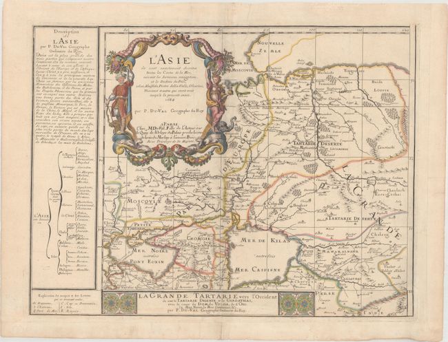
This is the northwestern sheet of Duval's scarce four-sheet wall map of Asia, depicting western Russia and extending south to the Black and Caspian Seas. Rivers, mountains, forested areas, roads and numerous towns are shown, including Moscow, Kiev, and Kabul. Some of the cartography is still conjectural, such as the Caspian Sea, which is depicted with an odd, round shape. At left is a brief description of Asia, followed by a diagram showing the political divisions of the continent and a legend identifying kingdoms, castles, sea ports, etc. Each of the four sheets stands on its own with a separate title cartouche and borders. This sheet also contains the elaborate title cartouche for the entire wall map, which is embellished with figures, animals, and flowers representing Asia.
References: Pastoureau, DUVAL II E [75].
Condition: B+
A nice impression with minor soiling. There are two small worm holes along the right-hand side of the large title cartouche that have been professionally repaired, with minute loss of image. Margins at right and bottom have been extended to accommodate framing.