Subject: Worcester County, Massachusetts
Period: 1857 (dated)
Publication:
Color: Hand Color
Size:
61.8 x 62.2 inches
157 x 158 cm
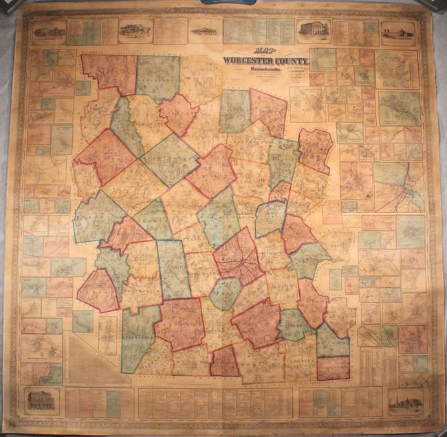
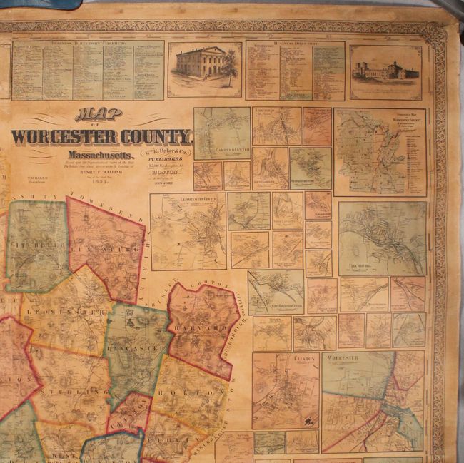
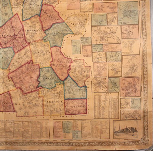
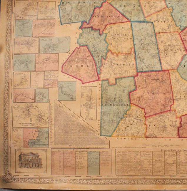
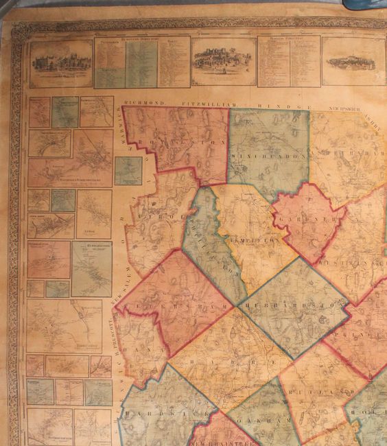
This impressive, large wall map of the county of Worcester is filled with detail. The map shows townships, towns, roads, railroads, rivers, and topography. Surrounding the map are dozens of insets of individual towns, detailing individual businesses and property owners, as well as a geological map of the county. There is a table of distances and another table of statistics based on the 1850 census, with information on population, education, churches, agriculture, and manufacturers. At top and bottom are business listings and vignettes of important buildings, including the Lunatic Asylum (prominently featured at top center), the State Reform School, a Town Hall, and the Female Collegiate Institute. Drawn on a scale of one inch per mile by Henry Walling, the Superintendent of the State Map, and published by William E. Baker & Co. in Boston and New York. Printed on four sheets, joined and backed in linen.
References:
Condition: B+
Very good condition for such a large wall map. There is light toning, some minor cracks, and small abrasions primarily near the edges of the sheet. There are several large chips in the border at top, entering several of the vignettes, that have been professionally replaced with the image in facsimile.