Catalog Archive
Auction 163, Lot 175

"A New Map of Georgia, with Part of Florida, Louisiana, and Carolina, Drawn from Original Draughts, Assisted by the Most Approved Maps and Charts. Collected by Eman: Bowen...", Schoolcraft, Henry Rowe

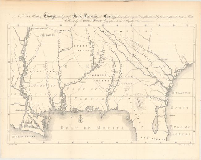
Subject: Southern United States, Georgia

Period: 1855 (published)

Publication: History of the Indian Tribes Vol. 5

Color: Black & White

Size:
18.5 x 11.8 inches
47 x 30 cm
Download High Resolution Image
(or just click on image to launch the Zoom viewer)

Schoolcraft used a simplified version of Emanuel Bowen's important early map of colonial Georgia to highlight the Indian tribes and villages in the region. The map covers from Charlestown to the Mississippi River and extends into Florida to below St. Augustine in the vicinity of the unnamed Cape Canaveral. In addition to the updated information on the Indian villages, many roads and trading paths are depicted, and there are significant differences to the watershed east of the Flint River.

References:

Condition: A

Issued folding with a few minor mis-folds, one tiny hole in the image, and light toning along the top edge of the sheet, not affecting map.

Estimate: $120 - $150

Sold for: $150

Closed on 6/14/2017

Archived