Subject: New Mexico
Period: 1898-1911 (circa)
Publication:
Color: Printed Color
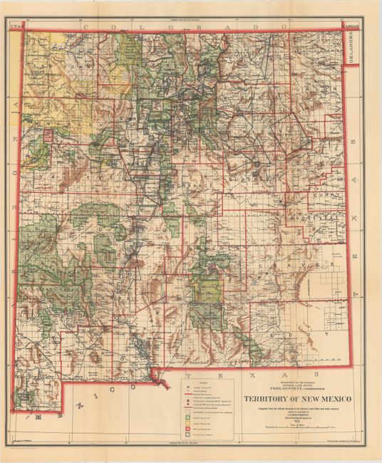
A. Territory of New Mexico, published 1911 (17.7 x 21.0"). This colorful and fascinating map was published it New Mexico's final year as a territory (statehood 1912). The extent of existing Indian reservations, Military reservations, Forest Reserves and Private Land Grants is shown through color and hash. The map is filled with information on watershed, mountains, railroads, wagon roads, unsurveyed townships, etc. The map was compiled by I.P. Berthrong, Chief of Drafting Division. Condition: Issued folding with light overall toning. (B+)
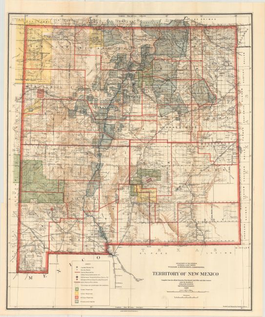
B. Territory of New Mexico, published 1903 (18.1 x 21.8"). A similar map to the above, published 8 years earlier. Unique to this map, however, is that Guadalupe County was renamed Leonard Wood and then returned to Guadalupe in 1905. This is the only map we are aware of that shows the short-lived county of Leonard Wood. The map was compiled by Frank Bond, Chief of Drafting Division and revised by Charles J. Heim. Condition: Issued folding with pleasant light toning. (A)
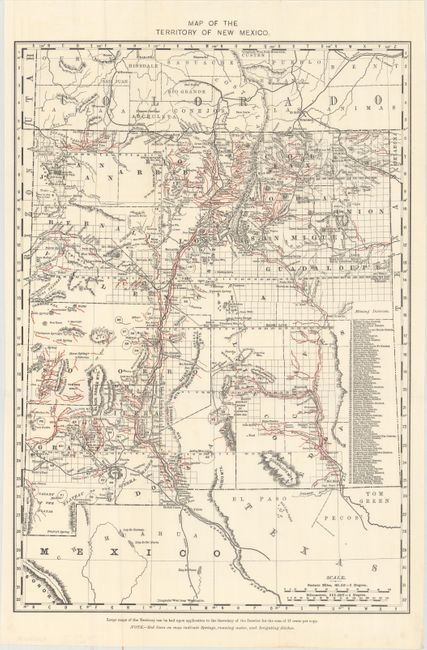
C. Map of the Territory of New Mexico, circa 1898 (13.1 x 18.8"). This detailed map identifies 80 mining districts which are listed in a table along the right margin. A note in the lower margin states "Red lines on map indicate springs, running water, and irrigating ditches." Condition: Clean, bright, issued folding. (A)
References:
Condition:
See description above.