Subject: World
Period: 1816 (dated)
Publication: Atlas Universel
Color: Hand Color
Size:
30.3 x 21.5 inches
77 x 54.6 cm
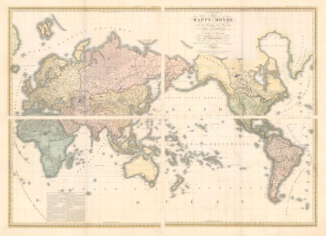
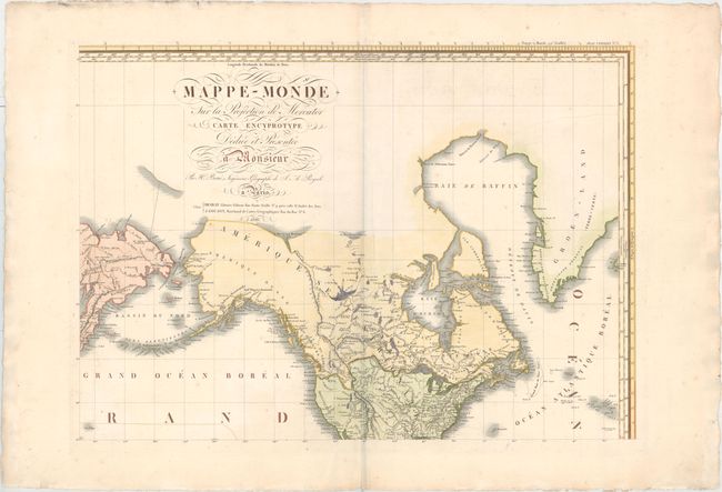
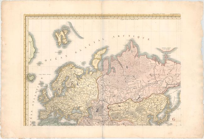
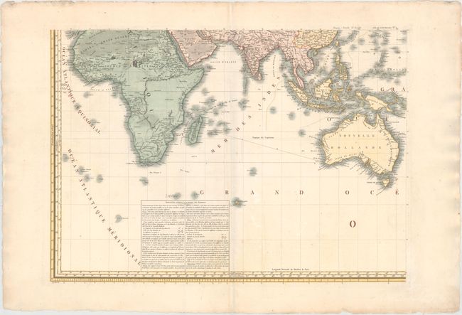
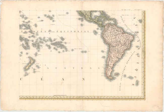
This uncommon large-scale map of the world was printed on four sheets. In North America, the topography reflects the reports of Lewis and Clark, Vancouver, and other recent explorers. The boundary between the United States and Canada reflects the British claim to the Columbia River. Africa's interior is left largely blank without fictitious topography. In the Pacific, New Zealand is shown with both its French title and the original Maori names for each island. There is an incomplete stretch of coastline north of Svalbard (Spitberg) that was observed by Dutch explorer Cornelis Giles in 1707. Numerous other discoveries and sightings are noted with names and dates throughout. A large text table gives instruction on measuring distances at different latitudes on the map. The size refers to each individual sheet.
References:
Condition: A
On watermarked paper with minor soiling and faint scattered foxing. There are small chips and short edge tears in the wide margins, well away from the map image.