Subject: Holy Land
Period: 1850 (circa)
Publication:
Color: Hand Color
Size:
9.8 x 13 inches
24.9 x 33 cm
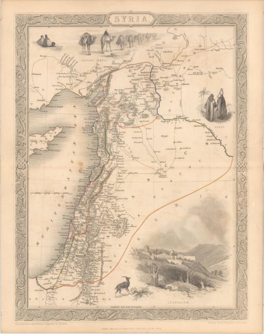
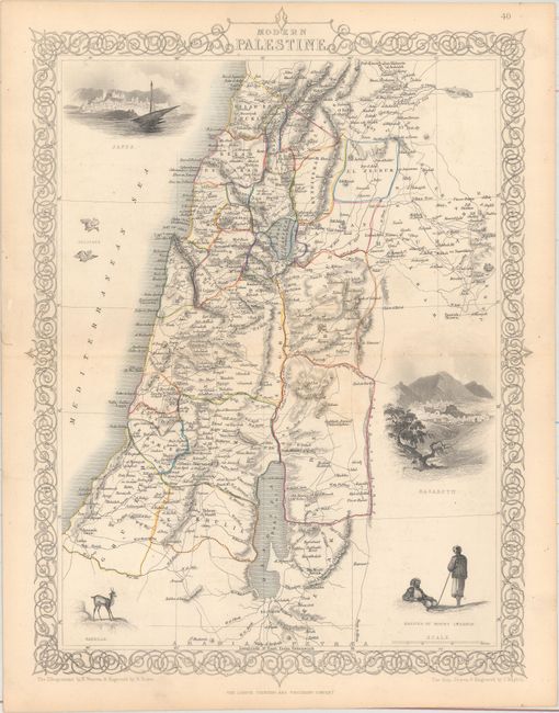
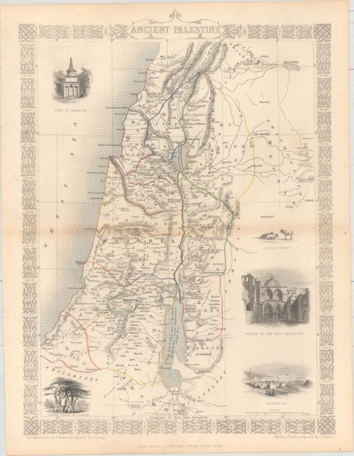
The maps from The Illustrated Atlas were first published in serial form to a target audience that led insular lives due to the expense and hardship of travel. All that changed as the progress of the nineteenth century brought swift and dramatic changes in public awareness of far away places. Tallis' maps no doubt played an important role in this dramatic awakening. These maps not only provided up-to-date geographical knowledge, but also used vignette views within the map's design to show the native people and their occupations, cities and points of interest. The maps hark back to a cartographic tradition from the Dutch mapmakers of the seventeenth century with finely engraved decorative borders. The maps were drawn and engraved by John Rapkin with views drawn and engraved by a number of prominent artists. The maps were issued as a complete volume from 1851 until about 1865. Some of the maps were also published in other history books published by Tallis including British Colonies and, without the vignettes, in geographical dictionaries and encyclopedias until about 1880.
A. Syria. Beautiful steel engraved map with Tallis' lovely vignettes and scroll borders. The Syrian map includes all of present day Syria, Lebanon, and Israel, with a bit of Turkey and Cyprus. Vignettes include Jerusalem, a camel caravan and Arab people. The map was drawn and engraved by J. Rapkin with H. Warren & J. Rogers engraving the borders and vignettes.
B. Modern Palestine [and] Ancient Palestine. This matched pair covers the region of Israel, Lebanon and part of Jordan. Each map is decorated with vignettes and a delicately engraved border. The vignettes of Ancient Palestine include the Tomb of Absalom, Ancient Cedars of Lebanon, Syrian Sheep, the Church of the Holy Sepulchre and Nazareth. The vignettes of Modern Palestine include Jaffa, Nazareth, natives of Mount Lebanon, and a Gazelle. Both maps were drawn and engraved by J. Rapkin.
References:
Condition: B+
Original outline color with light toning. The map of Syria also has faint color offsetting and a few spots.