Subject: North America
Period: 1791 (circa)
Publication: Atlas Universel
Color: Hand Color
Size:
23.3 x 19 inches
59.2 x 48.3 cm
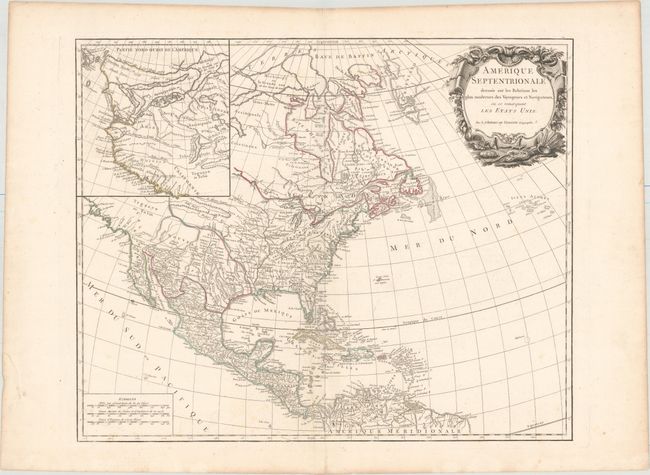
This is the sixth state of this handsome chart of North America with the removal of "ordinaire du Roi" from the title. The geography is identical to that of the fifth state, which presented several new elements including I. Shelrock, the Bermudas, and most importantly delineates the new United States. It also improved the configuration of the Great Lakes after d'Anville (originally drawn on the Bellin model). The new city of Washington has also been added to the map, which was named in 1791 by three commissioners overseeing the construction of the capital. The large inset Partie Nord-Quest de l'Amerique shows the northwest region with much of the mythical cartography of the day including Lake de Fonte (Sea of the West) and the River of the West flows to the Pacific from a large salt lake, Tahuglauks. The decorative title cartouche balances the inset in the opposite upper corner.
References: Pedley #450; cf. Sellers & Van Ee #8.
Condition: A
A clean and bright example on watermarked paper with original outline color, wide margins, and very minor soiling.