Subject: Eastern China
Period: 1796 (dated)
Publication: An Authentic Account of an Embassy from the King … to the Emperor of China
Color: Black & White
Size:
17.8 x 24.9 inches
45.2 x 63.2 cm
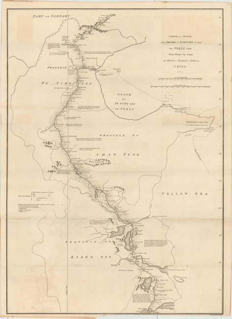
This scarce map records the first attempt by the British to negotiate more favorable trade agreements with the Chinese emperor. The 1792 embassy of Lord McCartney was granted an audience with Emperor Qianlong, but failed to secure the agreements. The map follows the Grand Canal from Hangzhou (here Hang-Tchoo-Foo) to Beijing (here Pekin), the longest ancient canal in the world. The official courier stations, each placed at intervals of 35 to 45 km, are noted along the route. Engraved by B. Baker and published from London on "April the 12th, 1796" by George Nicol. Map drawn by J. Barrow, who was the private secretary to Lord Macartney. He was later Secretary to the Admiralty and was a vice-president and founding member of the Royal Geographical Society.
References:
Condition: B+
Issued folding on a watermarked sheet with light offsetting, minor toning, and a touch of scattered foxing. Part of the margin at bottom has been trimmed close to the neatline, cutting off much of the publisher's imprint.