Subject: Eastern Europe, Russia
Period: 1711 (dated)
Publication: Atlas ou Recueil de Cartes Geographiques
Color: Hand Color
Size:
22.6 x 20.9 inches
57.4 x 53.1 cm
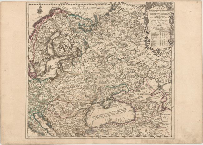
This fascinating map of Eastern Europe and the Russian Empire illustrates the seat of war for the Great Northern War (1700-21), which was led by Peter the Great of Russia, accompanied by its allies of Denmark-Norway and Saxony-Poland-Lithuania, against the Swedish Empire. This map was created half-way through the war, although it was published at the conclusion of the war, which ended with Sweden's defeat and Russia controlling the Baltic region. The map extends from the Gulf of Venice to the Caspian Sea and is filled with detail of towns, political boundaries, rivers and topography. The title cartouche is flanked with 9 medallions featuring the coats of arms from the region as well as a table of longitudes and latitudes of major cities.
References: Pastoureau, FER II C [59].
Condition: B+
Original color on watermarked paper with wide margins and light soiling. There is an old tape stain adjacent to centerfold at bottom that has been removed and professionally repaired with a tiny amount of image in facsimile.