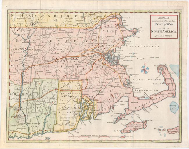
Subject: Colonial New England
Period: 1775 (published)
Publication: Universal Magazine
Color: Hand Color
Size:
15 x 11.3 inches
38.1 x 28.7 cm
This uncommon map was issued just following the outbreak of the Revolutionary War in October of 1775. It covers Rhode Island and Massachusetts with parts of Connecticut and New Hampshire. It depicts provinces, counties, townships, towns, meeting-houses, roads, forts, and landmarks along the Connecticut River. The March of the Provincials following the battle of Concord and Lexington is noted through Massachusetts.
References: Jolly #UNIV-173; McCorkle #775.11; Sellers & Van Ee #814; Phillips (M) p. 585.
Condition: A+
A very clean and bright example on watermarked paper - one of the best we have seen from a British periodical magazine. A binding trim at lower right has been replaced with old paper. Issued folding.