Subject: World
Period: 1537 (published)
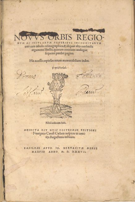
Publication: Novus Orbis
Color: Black & White
Size:
22.5 x 14.5 inches
57.2 x 36.8 cm
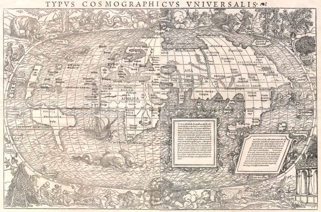
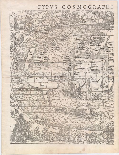
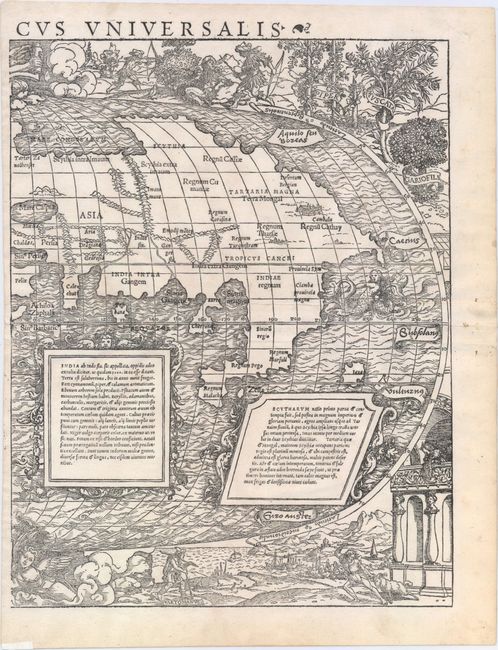
This striking oval woodcut map of the world was first published in the 1532 edition of Novus Orbis Regionum, an anthology of travel reports published by Simon Grynaeus and Johann Huttich. The work includes a commentary by Sebastian Munster, to whom the map is often attributed due to a statement within his commentary: "We have found it impossible to indicate the position of all of the regions and all of the islands, because the narrowness of our map did not allow it, and that was not our object." However, the map bears little resemblance to Munster's maps of the world and western hemisphere published in 1540. The nomenclature, distribution of land, and geographical depictions are starkly different between this world map and Munster's other work. It is more likely that Munster's commentary used the terms "we" and "our" to reference the collaborative effort of putting together Typus Cosmographicus Universalis, rather than admission of his own efforts related to it. The highly decorative nature of this map is quite unusual for the early 16th century. The masterful engraving of the embellishments has led scholars to believe that the map was designed by Hans Holbein the Younger, who engraved vignettes for Munster and others in Basel between 1528-32.
Although the authorship of this map is debatable, its rich artistry is undeniable. The oval projection is surrounded by vignettes depicting various people and fauna from around the world, both real and mythical. At bottom left are the cannibals of South America, with body parts roasting on a spit and hanging from a teepee-like structure. At top left are the Ubangi people of Africa displaying lip plates, a hunted elephant who appears to have captured a human of his own, and winged dragons devouring a horned sheep. At top right is an additional hunting scene along with depictions of several plants. And at bottom right is Lodovico de Varthema, an Italian adventurer, returning to a European seaport to tell of his travels in the Middle East and Asia.
However the most fascinating, and revolutionary, decorative elements are the two angels hovering at the north and south poles, turning crank handles to rotate the world on its axis. This concept of keeping the world in motion was innovative in the early 16th century, when it was still believed that the universe revolved around the earth. In fact, Copernicus' ground-breaking and controversial theory of heliocentrism wasn't published until 1543 in his De Revolutionibus Coelestium. It is possible that the map's author was aware of Copernicus' principles either by word of mouth or from a brief manuscript edition of Copernicus' Commentariolus, which began circulating around 1529.
Within the oval itself are additional embellishments, including a galleon, several dolphin-like sea monsters, and a siren off the eastern coast of Asia.
Geographically, the map is antiquated. There are no signs of a southern continent, despite reports from the first circumnavigation of the globe in 1522, led by Magellan. The map generally follows the models of Waldseemuller's world map of 1507 and Apianus' world map of 1520, showing America as a separate continent between two distinct oceans. However, the map's author tries to reconcile between Waldseemuller's map and Columbus' claim that Cuba was not an island by depicting North America with an elongated shape and named Terra de Cuba, and showing only one (rather than two) large islands to the east, yet labeled as both Isabella (Cuba) and Spagnolla (Hispaniola). To the north is Terra Cortesia, a representation of Newfoundland. Another interesting aspect is the representation of Japan, Zipangri, which is shown closer to North America than to Asia.
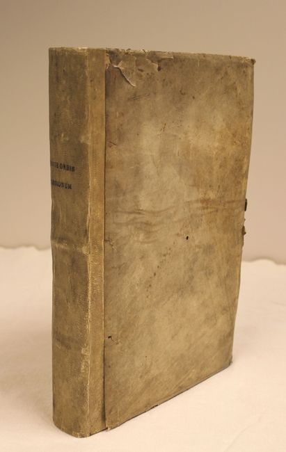
The map is accompanied by the 1537 edition of the Novus Orbis Regionum, in which the map was originally published but has since been removed. The work includes accounts of the expeditions of Columbus, Vespuccio, Marco Polo, and Varthema, among others. Small folio, 598 pp. Bound in full vellum (not original) with title stamped on spine and new endpapers.
References: Shirley #67; Harrisse #198; Suarez (Shedding the Veil) #21; Nordenskiold, pp. 105-6; BMA #65.
Condition: A
The map is clean and bright with wide, original margins. The left-hand sheet has professional repairs to one small and three tiny worm holes along the centerfold, with a minute amount of image replaced in facsimile. The right-hand sheet has a centerfold separation that enters 1/2" into image at left and has been professionally repaired. The text is also clean and bright with very minor soiling. Sebastian Munster's name has been blacked out in old manuscript ink in the table of contents and his commentary section, causing a hole in the title page at top. The title page has several old ink notations. The hinges are starting and the covers are heavily worn, with the vellum beginning to detach from the covers. Please note that the image of the map as a whole is a composite image - the two sheets are not joined.