Subject: Atlases
Period: 1666-68 (dated)
Publication:
Color: Black & White
Size:
6.6 x 4.3 inches
16.8 x 10.9 cm
This handsome miniature atlas is famously known as the "miniature Speed" atlas since the maps, engraved by Pieter van den Keere, were based on John Speed's folio-sized maps published under the same title, A Prospect of the Most Famous Parts of the World. This example is a dual atlas containing both the world atlas and an atlas of the British Isles. Both atlases had an interesting publication history, beginning with the atlas of the British Isles, which was first published between 1605 and 1610. In 1619, the British Isles maps came into the hands of London printer George Humble, who included additional maps and reprinted them under the name of John Speed, thereby initiating the popular series of "miniature Speed" atlases. The success of the miniature Theatre was then joined in 1646 by the first edition of the miniature Prospect atlas published by George Humble's son, William Humble, and was sometimes bound separately from the British Isles atlas and sometimes bound in a dual atlas.
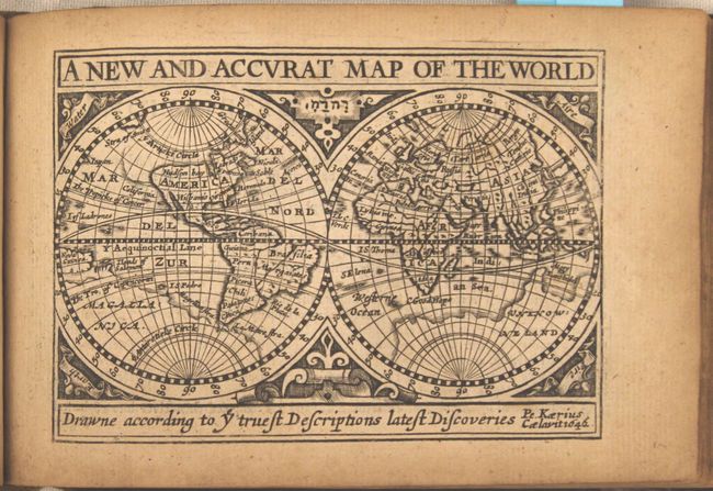
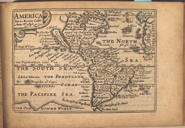
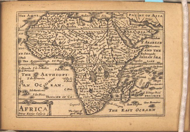
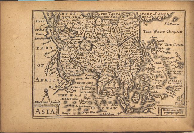
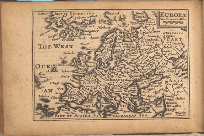
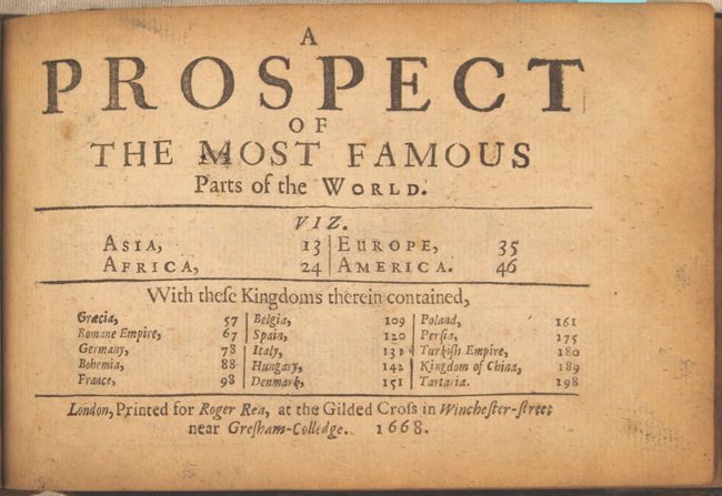
The miniature maps in A Prospect were engraved by Van den Keere while in his 70's, and are believed the be the last maps engraved by him before his death at the age of 75. The atlas is complete with 20 maps: the world, Asia, Africa, Europe, Americas, eleven maps of European countries, Persia, the Turkish Empire, China and Tartary. Each of the maps is single page with text on verso taken from Speed's folio atlas, and all are signed with Van den Keere's Latinized name, Petrus Kaerius. The simple, typographic title page contains the list of maps and is dated 1668 with the imprint of Roger Rea. The double-hemisphere world map, "A New and Accurat Map of the World," depicts a huge southern landmass, labeled Unknowne Land in the eastern hemisphere and Magallanica in the western hemisphere. The northwest coast of North America shows a conjectural coastline that extends to the Strait of Anian. Although the world map shows a peninsular California, the western hemisphere map, America, depicts California as an island with a flat northern coast and several place names. The cartography of this map is based on Goos' folio map from 1626, and omits any French presence in Canada. Newe Ing. Land is located north of the St. Lawrence River, and Plymuth is the only European settlement depicted.
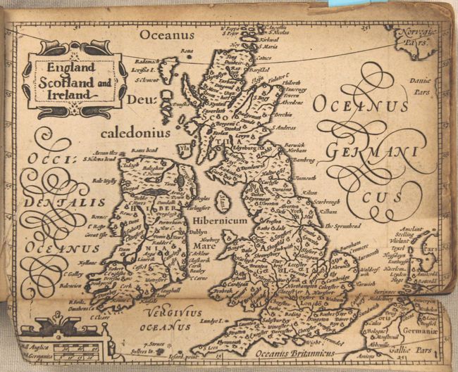
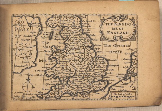
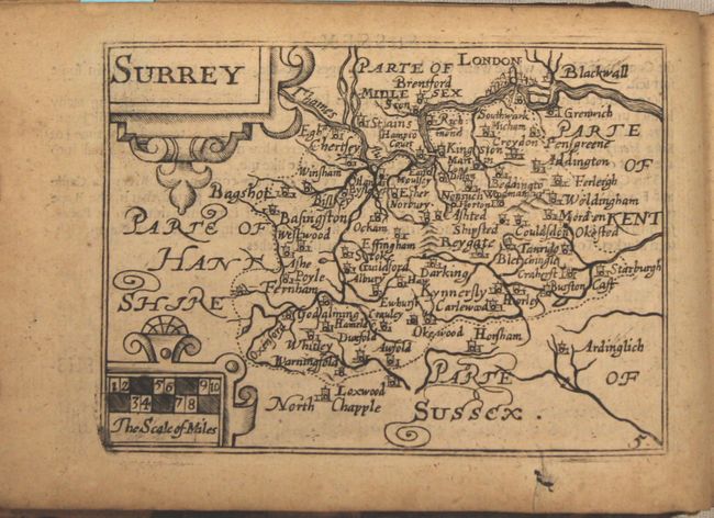
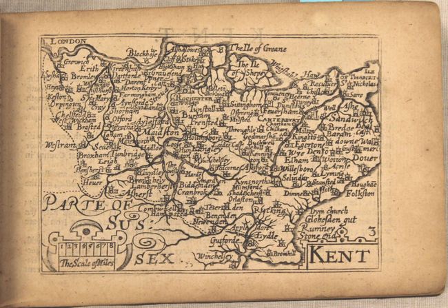
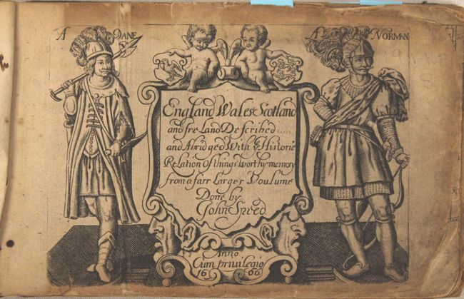
There are 62 (of 63) maps in England Wales Scotland and Ireland, including the folding map of the British Isles, separate maps of England, Wales, Scotland and Ireland, and 57 county maps. (The map of Yorkshire is missing.) The majority of the British Isles maps were also engraved by Van den Keere and were based on Saxton for the English and Welsh county maps, on Ortelius for the Scottish maps, and on Van den Keere's own map of Ireland for the Irish maps. It is believed that the maps of the British Isles and of England were not engraved by Van den Keere, but were commissioned by Humble for the 1627 edition. The British Isles map was based on Blaeu's miniature edition of Camden's Britannia, and the England map was based on Speed's folio map, omitting the costumed figures. The text in this atlas was derived from Speed's Theatre of the Empire of Great Britain. The title page is dated 1666 and features two putti, a Dane and a Norman.
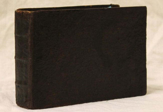
Full leather with raised bands on spine and the initials "WP" stamped on front and back covers.
The provenance of this atlas is quite fascinating, as it comes from a direct descendent of the cartographer John Speed. The Speed family believes the atlas was purchased in the 1800's and then passed down from generation to generation.
References: Shirley (BL Atlases) T.KEE-1i; Shirley #368; McLaughlin #8; Burden #268; Shirley (BI to 1650) #394-5
Condition: B+
All the maps except for two are in very good condition, with light overall toning and an occasional spot of foxing. The title page of the British atlas and the British Isles folding map are in good to satisfactory condition with heavier toning, soiling, and several fold separations and small chips. The map of Radnor has a hole apparently caused by a paper flaw, and several county maps have short tears primarily confined to blank margins, all of which have been archivally repaired. The last few pages of the text block are heavily toned around the edges caused by contact with the leather, which does not affect any maps. The covers and spine are heavily worn but have been recently conserved, with numerous small chips and cracks to the leather repaired.