Catalog Archive
Auction 147, Lot 670

"A Map of the Nile, from the Equatorial Lakes to the Mediterranean, Embracing the Egyptian Sudan (Kordofan, Darfur, &c.) and Abyssinia", Stanford, Edward

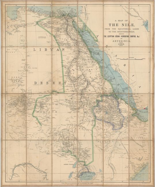
Subject: Northeastern Africa

Period: 1883 (dated)

Publication:

Color: Hand Color

Size:
21.3 x 25.9 inches
54.1 x 65.8 cm
Download High Resolution Image
(or just click on image to launch the Zoom viewer)

This folding map spans from the Mouths of the Nile in the Mediterranean down to Lake Victoria. Many African nations, cities, rivers, lakes, and mountains are identified. Stanford took control of his partner Trelawney Saunders' map dealership at the age of 25 and was prolific and popular in a time when British colonial expansion increased the public's demand for maps of the world.

References:

Condition: B

Issued folding and backed in linen with some light foxing and faint soiling.

Estimate: $160 - $190

Sold for: $130

Closed on 11/20/2013

Archived