Subject: Arabia
Period: 1654 (dated)
Publication: Cartes Generales de Toutes les Parties du Monde…
Color: Hand Color
Size:
19.3 x 15.8 inches
49 x 40.1 cm
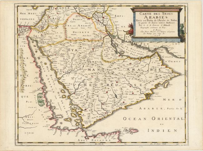
This beautifully engraved 17th century map is one of the first large maps focused specifically on the Arabian Peninsula. This map shows much new information regarding the location of towns and usage of contemporary place names, reflecting the increasing knowledge of the area at the time. Sanson's map of the Arabian Peninsula continued to influence maps of the region throughout the latter part of the 17th century. On this map, Arabia is divided into three regions: Arabie Petree, Arabie Deserte, and Arabie Heureuse. There is great detail of mountains and rivers, although there are clear geographical errors, such as the exaggerated extent of the mountain ranges. Numerous tiny villages are depicted, including stopping places on the pilgrimage to Mecca (Iathreb, Badrahenen, Gioffa, and Cadaid, among others), as well as towns that appeared for the first time on a map of Arabia (Hagair, Hadrama, Salamia, and Iamama). Bahrain is also delineated. The map is adorned with a large columnar style title cartouche. Engraved by Jean Somer.
References: Tibbetts #98; Ankary, p. 98, #60; Couto #61; Pastoureau, Sanson V [6].
Condition: A
Watermarked paper with attractive color.